Today was the day I broke. I am pleased (and will eventually be proud) to report that I did not break at any of the expected moments, but waited until about an hour after we made it to our guest house for the night.
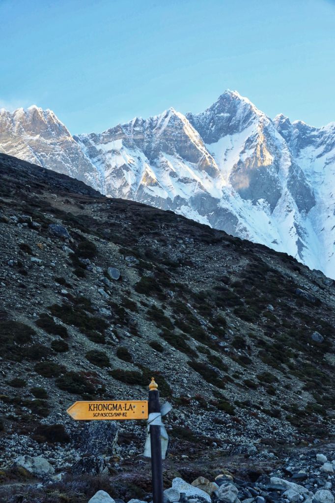
Today’s hike, as previously advertised, took us over Khongma La pass at an elevation of 5,535m (18,172 feet). We got on the trail at 6:15am, after a breakfast that was hard to eat because that hour is just too early for food.
We did a first rate job going bistari, bistari. Slowly, slowly. It truly is the only option at these elevations. Even so, we managed to pass a group of Swiss hikers an hour or two in, and never got repassed by them. Of course, two dudes with bulging calf muscles passed us at about the same time, and we never even saw them again.
Slow as we were, I would say we acquitted ourselves with considerable awesomeness on the way up.
We celebrated every 100 feet of elevation gained, especially after 17,000. These elevations are mind-boggling. There’s simply nothing in my experience to compare them to. Imagine being on the top of a 14er in Colorado. Now imagine being 3,000 feet higher than that. Now imagine that there’s a mountain towering yet another 11,000 feet above you. It’s just… impossible. Sometimes I gaze up into the clouds only to find a shadow up there that turns out to be a mountain. It can make a body dizzy.
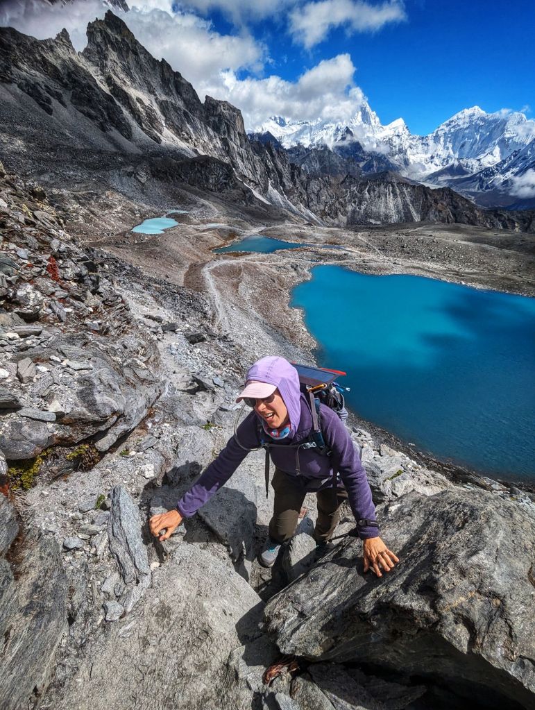
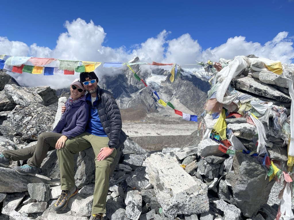
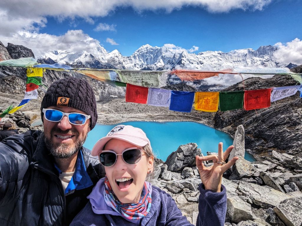
Lhotse, Tabuche, and Ama Dablam kept watch over us for the upward portion of today’s hike. Ama Dablam (6,812m/22,343f) looks big because it is so close. Lhotse’s immensity (8,414m/27,598f) is obvious even though it is much farther away. Confusingly to me, Lhotse seemed to get bigger and bigger the higher up we got. Perhaps because from higher up, it becomes easier to understand how tall she actually is? Something that looms an extra 13,000 feet above where you stand makes less sense to your brain than something of which you can see 9,000 feet above and 4,000 feet below??
In any case, Lhotse is utterly amazing. We won’t get such wide-frame perspective on Everest, so I’ve been soaking up as much Lhotse-love as I can.
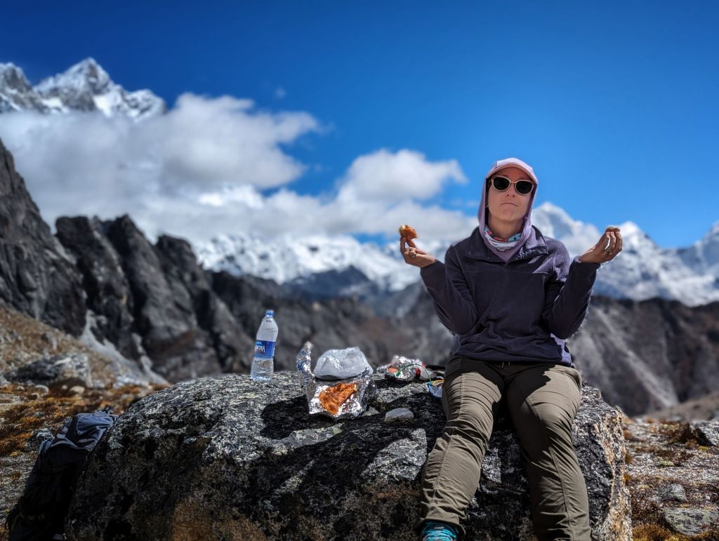
We stopped to eat just below 18,000 feet. The hotel had packed us a lunch of Tibetan bread (a lot like Indian fry bread) and boiled eggs. I managed half a piece of bread and one egg, even though I think boiled eggs are gross and even though I had no more interest in eating now than I had at breakfast. Elevation plays games with your appetite, but we were burning a not-insignificant number of calories, and an effort had to be made.
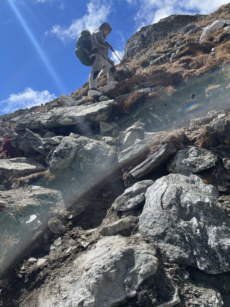
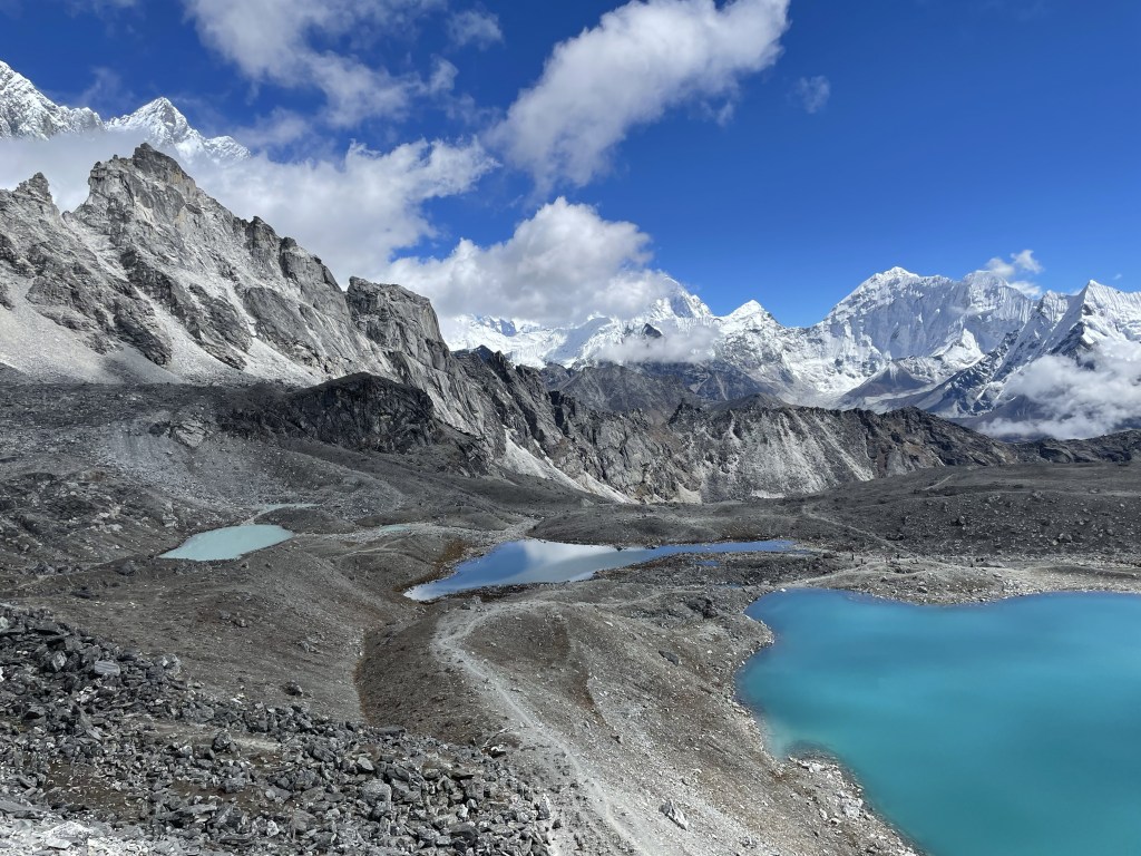
The final approach to Khongma La pass is brutal. When we came over the last rise and I saw the apparently vertical wall of rock above a stunning turquoise lake, my resolve nearly failed me.
Let’s talk about how hard it is to move at these elevations. I look back at poor, sad Laura, collapsed on a rock in Colorado at 11,700 feet, and I find her adorable. Hiking into Dingboche two days ago at 14,000 feet was a piece of cake. At nearly 18,000 feet (and then above), it’s like your brain is sending commands to your legs, but your legs are surly teenagers who will get around to it when they get around to it. All my blah-blah self-congratulations about being able to move so steadily, if slowly, goes right out the window here. Slowly, at these elevations, is almost an understatement, and I still have to stop every 20 steps to catch up on breathing.
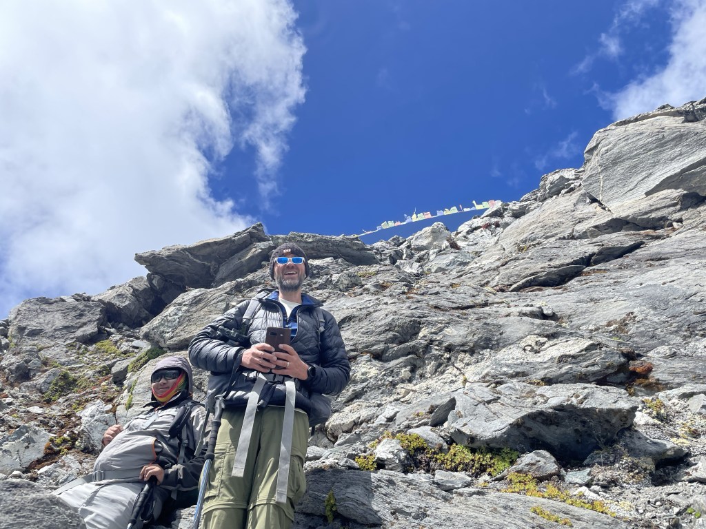
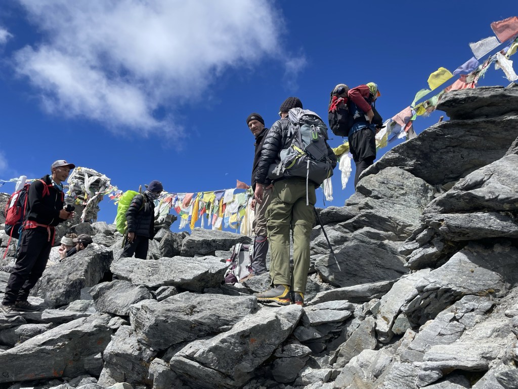
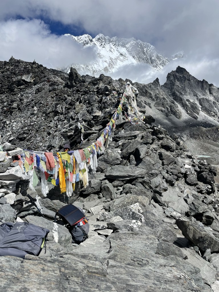
But even that pace will, astonishingly, get you there eventually. We clawed ourselves up that 200-foot wall of rock (it really was nearly as vertical as it had looked) and were met at the 18,172-foot pass by a festival of prayer flags and other hikers who had tackled it from the other direction.
A million photos were taken. I found a good lounging rock and basked in the glow of all the mega-mountains around us, and in my success which, all things considered, I’d gotten to have with relative ease.
Stats for the first half of the hike:
- Starting point: Chhukhung, 4,757m (15,604 feet)
- Ending point: Khongma La, 5,535m (18,172 feet)
- Elevation gain: 778m (2,552 feet)
- Distance traveled: 3.5 miles in 4:40 of active hiking time
- Average pace: 1:20’43” per mile
- Slowest mile: 1:48’12” (yup. Almost two solid hours to make that final mile and thousand feet of elevation to the top.)
I’d have been happy to bask at the top for hours, but another entire half of the hike awaited us.
It seems to me that, having accomplished such a significant feat as an 18,000-foot pass (having never hiked higher than 15,600 feet just the day before), that one ought to be excused from everything else after that.
Nope.
A downward hike of equal elevation-change and slightly longer mileage awaited us. Up is hard. Down is brutal. Down hurts.
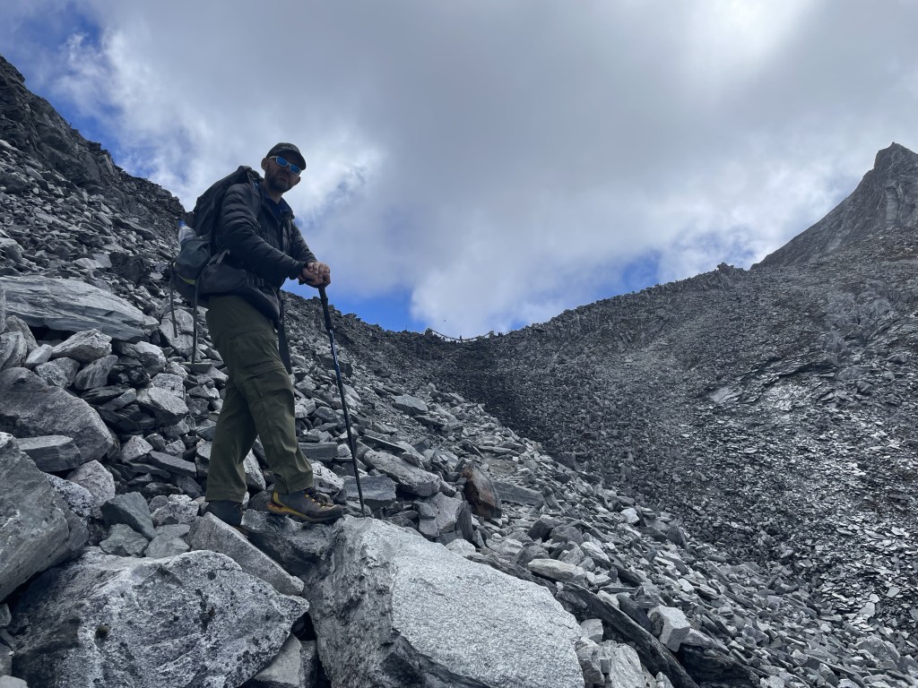
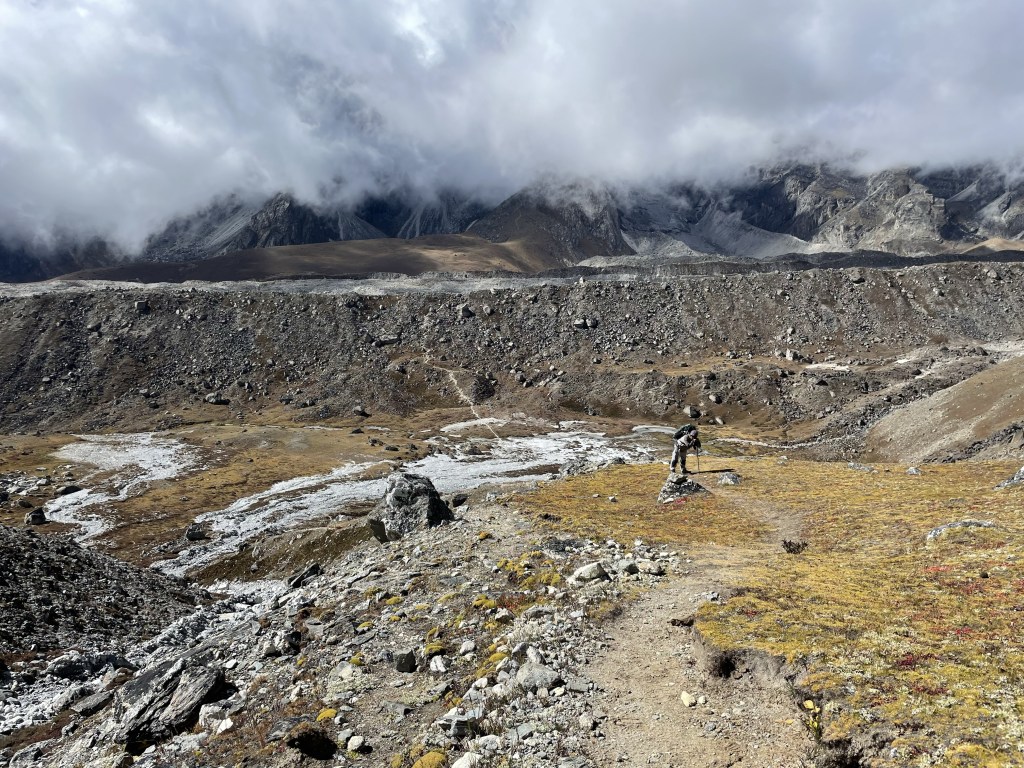
We stumbled our way down and down across fields of loose boulders and scree. We could see our destination, the village of Lobuche, from a long way up, and it never seemed to get any closer.
How could there be so much down?
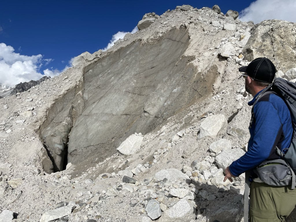
At some point, I realized we’d have to descend to a point considerably lower than Lobuche before climbing up the wall of the Khumbu glacier moraine (the rocks the glacier pushes out of its way as it moves) in order to then cross said glacier, and again my spirit quailed.
The body was so tired. I started wondering when I would sit down on a rock and refuse to get up again, so they’d have to send a helicopter (or at least a donkey) to rescue me.
I suddenly remembered (and then couldn’t stop thinking about) the fact that most people who die on Everest die on their way down. They give everything they have to the summiting effort, so that on the way down, they’re too tired and too stupid (literally) to make good and safe decisions.
Had I done that?
I had a pretty significant headache that had started not long after we began the descent, and my digestive system had started malfunctioning. Was altitude sickness finally coming for me? I definitely hadn’t eaten enough. I’d been a champion water-drinker, so it wasn’t that. Was I salt deficient?? Dying of water poisoning would be nearly as stupid a way to go as falling off the mountain after slipping on yak poop.
But I kept asking my body, “can you really keep going?” and my body kept answering, “yes, at least a little more.”
Some of it was lack of other options, helicopters and donkeys notwithstanding. Some of it was that my body really has been rising to the challenges on this adventure. Some of it was my brain, magnificently taking care of me for a change, rather than dwelling on all the gruesome and fatal ways things could go wrong.
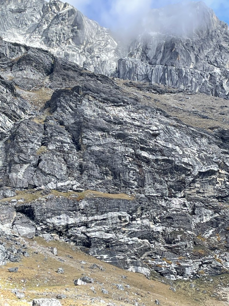
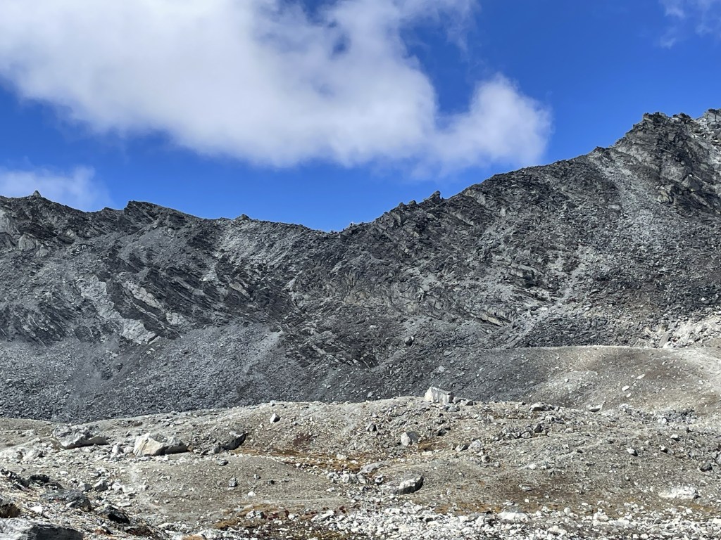
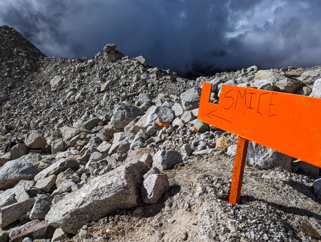
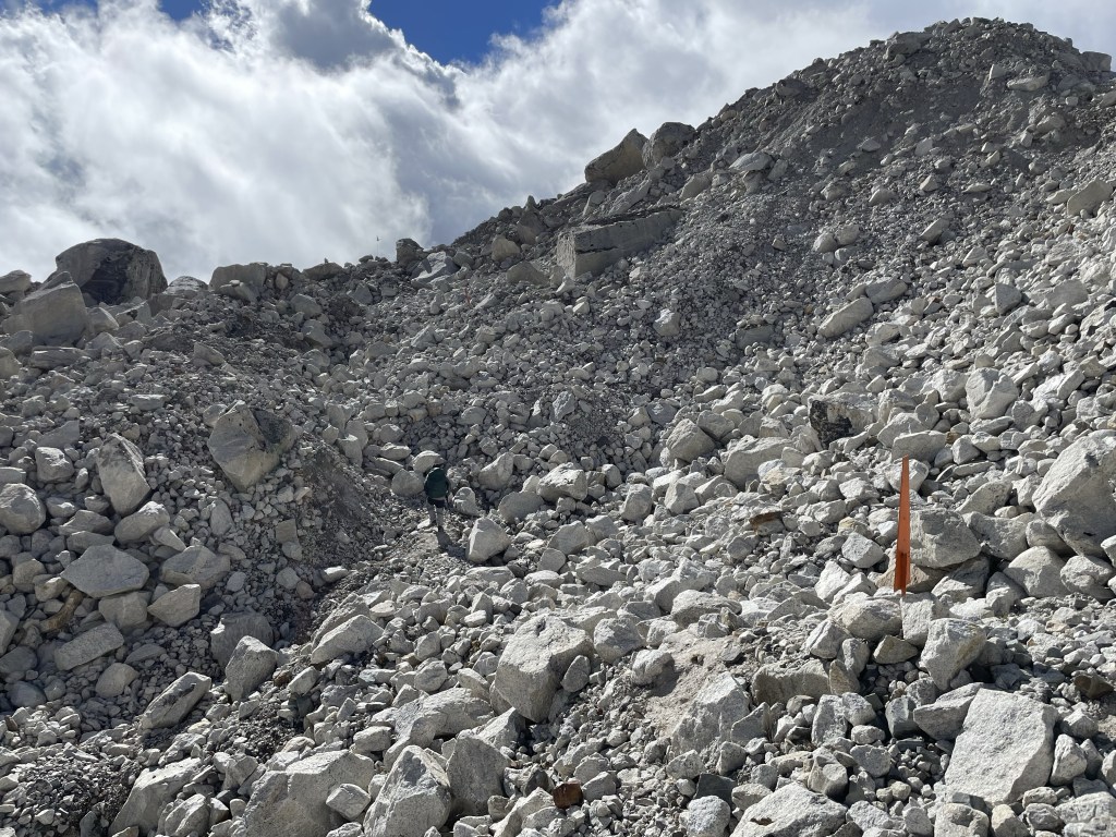
The glacier, awesome though it was, was a nightmare. The moraine was 200 feet high, with signs at the top indicating that the easy way through had collapsed (because glaciers are fricking dangerous) and we’d have to take a detour. A long one.
The rolling fields of loose (really loose) glacial boulders reminded me of our Mount St. Helens climb. Just as you thought you were getting to the end, another wave of boulders appeared. At one point, as we crossed a melt field (a little lake in the middle of the glacier), a portion of rock collapsed from one of the ice walls behind us, landing in the water with a splash. Dustin and I stood and stared while Surya, safe on the other side, hollered at us to “come on come on come on!”
“If you hear noises on a glacier?” Surya advised us, just a little too late, “never turn around, just go go go!”
In his defense, apparently he’d never seen that happen before.
We escaped the danger part of the glacier unscathed, though the experience was unnerving. And still, so many waves of boulders remained.
Somehow, finally – finally – we made it to the other side, and Lobuche came into view at a distance that didn’t seem completely impossible. The final trudge was accomplished almost robotically (and with one urgent stop behind a rock which, ultimately, was probably more comfortable than if I had managed to make it to the communal toilet at the crowded guest house).
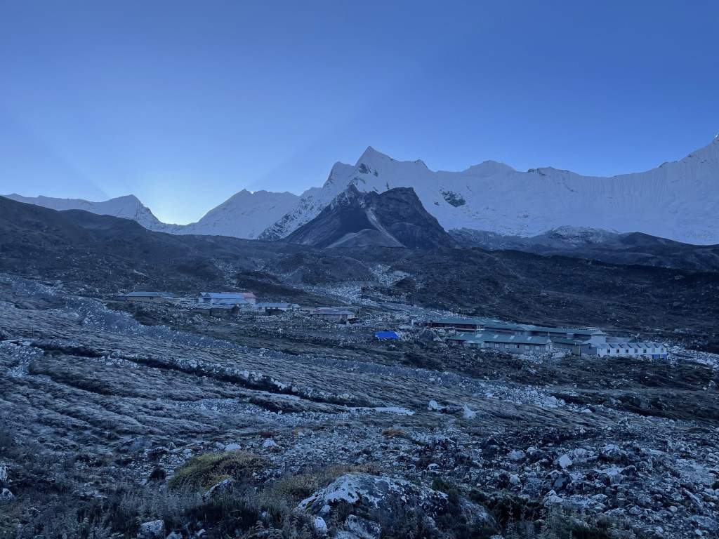
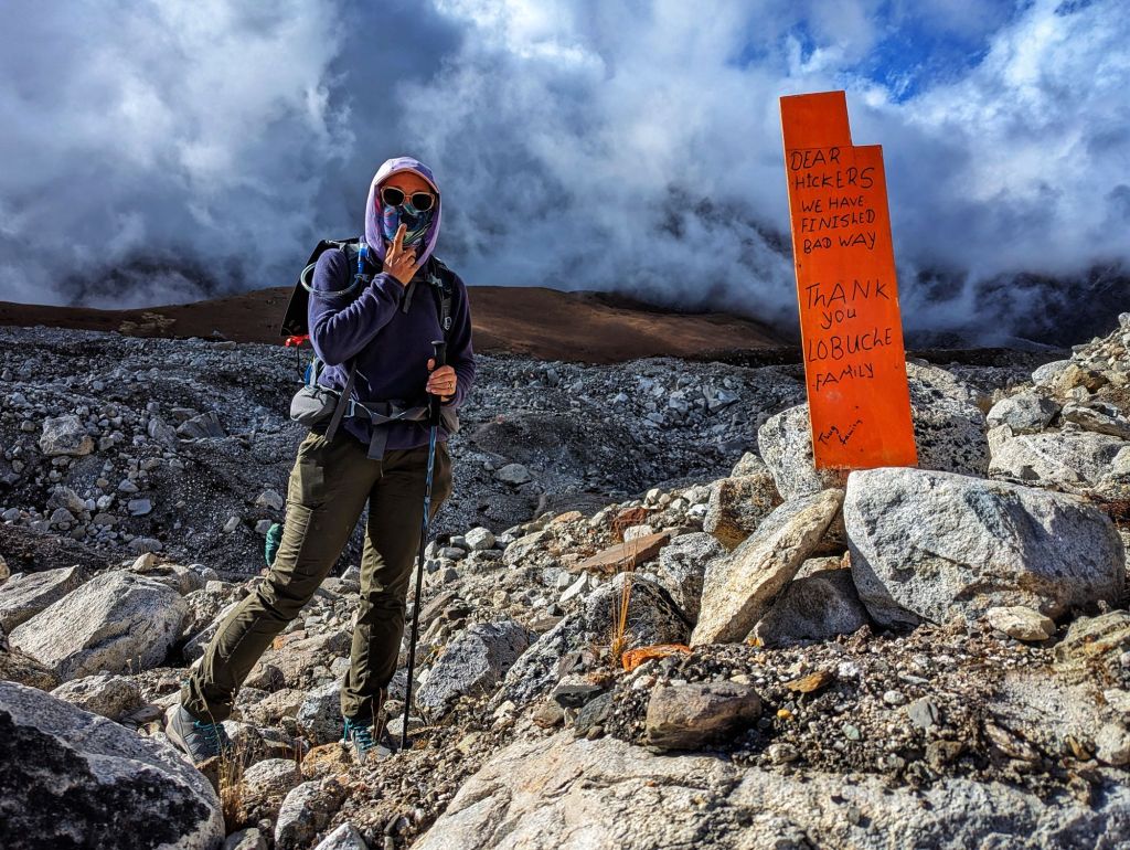
And oh, was the guest house crowded. The trip over Khongma La pass is taken by a very small percentage of the people who visit here every year (“less than 5%?” Surya guessed). As a result, we’d spent the day in blissful near-solitarity. We guessed maybe 30 total people went over the pass, including both tourists and guides. Not a single yak.
But Lobuche? Lobuche is back on the main route to Everest Base Camp, where 98% of trekkers are destined.
We shuffled into our guest house’s dining hall, got our water bottles refilled, wedged ourselves into seats at an already-occupied table for lack of other options, and then stared into space. That was all I could manage for about half an hour.
“I don’t know if I can do that again,” I finally said. Tomorrow’s trip to Base Camp is listed as an 8-9 hour trek, where today’s adventure had been listed at 7-8 hours. It had taken us almost 10.
Dustin nodded. He was feeling it too.
We discussed possibilities, including forcing a rest day at the expense of some other stop on the itinerary, calling the whole thing quits and starting back for Lukla tomorrow, and a large number of options in between. Dustin was nothing but supportive of any change I might feel like we’d need to make.
Which, perhaps, is why the end of this conversation is when I dissolved into tears. I had finally found the end of my rope here, an hour after getting off the trail. No helicopter or donkey required.
I’m at least as proud of that as I am of getting over the pass.
Three hours later, rehydrated and full of dinner I ate even though I didn’t want to, I feel worlds better. We’ll start tomorrow as planned, while reserving the right to change our minds and do something different any time.
After all: I have nothing to prove, here, only mountains to adore.
Final tally for the day:
- Starting point: Chhukhung, 4,757m (15,604 feet)
- Highest point: Khongma La, 5,535m (18,172 feet)
- Ending point: Lobuche, 4,928m (16,165 feet)
- Total elevation gain: 890m (2,919 feet)
- Distance traveled: 7.6 miles in 8:01’46” of active hiking time, 9:42’ total
- Average pace: 1:04’01” per mile
- Slowest mile: 1:48’12”

Obviously, you’ll see this comment after you’ve finished whatever you’re going to do (or have done), but regardless: no matter what happens going forward (or has happened–time is weird), you succeeded. Congratulations!
LikeLike