The last time we got up stupid early to cross a pass, I was still battling jet lag, and hardly even noticed the evil hour. Apparently, I’m over that now, because 4:30am really hurt today.
I turned up in the dining hall for my pre-hike hot tea unprepared to face cheerful Surya, who has not yet had the pleasure of dealing with Crabby Morning Laura.
(Laura who was crabby when we did Kala Patthar managed to keep it mostly to herself.)

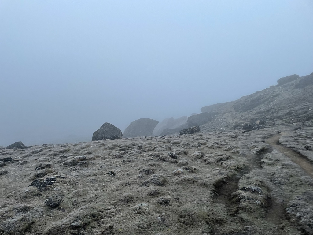
Fortunately, we all survived and got onto the trail by 5:30. It wasn’t exactly dark, but it certainly wasn’t light yet, either. It didn’t help that clouds had settled in, and forecasts predicted the same all day, with the bonus possibility of snow.
This is the weather I’d dreaded the day we crossed our first pass. We were so fortunate to have beautiful weather for Kongma La. If we’d been socked into clouds, with no view in exchange for all the effort, I think it might have been donkey-rescue for me, after all.
Since the weather at Kongma La had been so perfect, and since I knew better now what to expect from a trip to 18,000 feet, I knew I could handle today’s hike in the gloom, but it certainly wasn’t helping with my crabby problem.

And then, about 45 minutes into my mirthless trudge, a glimmer of something appeared in the sky above. Maybe we’d get a little dose of the sun after all? But no… the sun should have been rising behind us, not in front of us.

It was not sunrise, but mountainrise. The sun, shining brightly above what was apparently only a thin scrim of clouds, was lighting up the peaks in front of us so brightly that they glowed through.


Ten minutes later, we hiked up out of the clouds into full sunlight. Peaks glowed before us and clouds pooled behind us. This, finally, did much to improve my mood.

“What are the names of these peaks?” I asked Surya. They were brand new to me. Ama Dablam and Arkamste were still visible behind us, but we’d turned a bend and were coming into new mountain territory.
These mountains had saved my morning. It seemed important to learn their names as soon as possible.
“These??” Surya said. “These are hills.”
I gazed up at my glowing beacons of happiness, all 5,600+ meters of them (18,500 feet) which, to be fair, were barely capped with snow.
“Those are pretty awesome hills,” I said.
Being in a better mood did not, however, do anything to improve my performance. I was so tired. I felt like 20-pound weights had been strapped to each leg. For the first time, Surya didn’t have to tell me to take breaks.
After what felt like endless hours of dire up, but which turned out to be merely 1,500 feet over 3 miles – a fairly gentle grade, all things considered – we reached the toe of the much-discussed snow field.
“Snow field” is what everyone has been calling it, but I’m here to tell you: it’s a glacier. If it somehow doesn’t qualify to be a real glacier, here in the land of mega-glaciers, it’s certainly bigger than most glaciers I’ve gotten to see in the States.

This was where Orientation Man, back in Kathmandu, had warned is passage would become dangerous and technical.
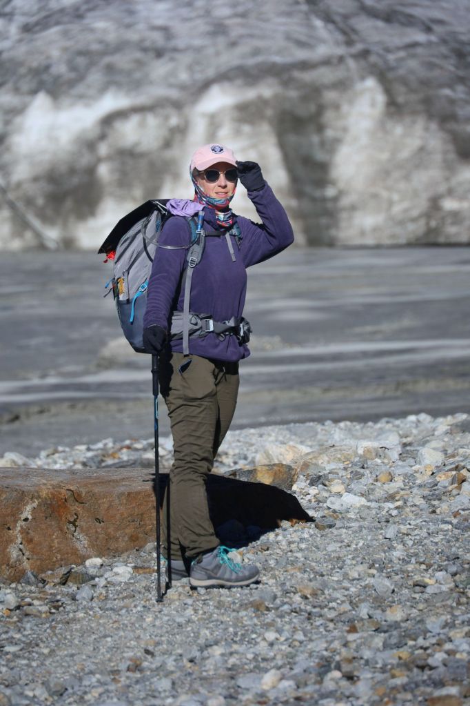
“You don’t need crampons,” Surya practically scoffed as Dustin and I pulled our microspikes out of our bags. I believe he was correct – most people stepping out onto the glacier did so in their boots without any kind of hesitation, and seemed to be doing just fine. But Parash had stopped to pull chains over his shoes, and if the porter wants chains, I do too.
Besides. We’d hauled them all this way.
This glacier did not feel dangerous, despite the dire warnings of Orientation Man and also our map, which labeled the area as “slippery path, possibility of rocks falling, difficulty icy crossing, dangerous crevasses”.
The only crevasses I saw were about two inches wide and maybe a foot deep. (Alas, for my curiosity.)

This glacier felt entirely solid. I quite enjoyed my safe-feeling tromp across it, though I would never have been so bold as the guy who went about 50 feet off the marked path in order to lay down in the undisturbed snow for a photo-op. Influencers. Pft.

I bistari, bistari’d myself almost all the way across that glacier with the most impressive display of effort I’d managed all day. About 90% of the way there, though, I started feeling… overbaked? We were trudging uphill over ice at 17,500 feet, but the sun reflecting off the snow all around us had upped my internal temperature considerably.

I am the kettle.
“You good?” Surya asked, a check-in made regularly, every 20 minutes or so.
For the first time ever, I gave him a “so-so” hand in reply.
“We’ll take a break,” he said. “At the top.”
It occurred to me he might have meant “at the top of the pass,” but I struggled across the last hundred feet of ice and veered off and toward the first rock I saw that looked unlikely to be hiding a snow-well.
(Snow-well: the heat of the sun on a rock causes the snow around it to melt into a giant hole that then gets covered by a thin layer of new snow causing tired trekkers to fall into the sneaky hole and never be seen again.)
I peeled off layers and sucked down water, but I needed a lot more rest than a typical breathing break before I felt up to tackling the 100-foot wall of rock that remained.
“Take your time,” Surya said when I indicated that no, I was not ready to go yet. “It’s not a marathon.”
If he was going for euphemism, he should have said it is a marathon, not a sprint, but I like his version better. “It’s not a marathon” acknowledges that the day’s event is long and difficult, but that no one is being timed, and certainly no prizes are on offer. No reason to go any faster than the body is willing.
Ten minutes later, though, we’d almost caught up with the group ahead of us who hadn’t taken a break as we climbed the last few feet to Cho La pass: 5,420m (17,614f).
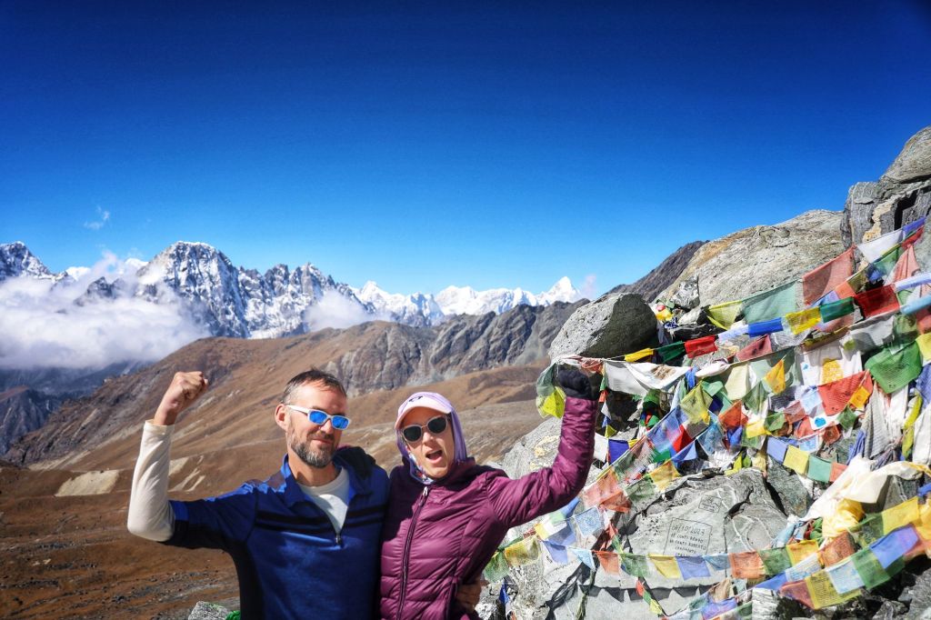
Rest. Snacks. Photos. It was beautiful, if not as striking to me as Khongma La had been.


This time, I was mentally prepared for the Down. The descent on the west side of Cho La is viciously steep, and Orientation Man had again been right that a fixed line had been installed to aid trekkers, but wrong about it being in any way technical. The line was there to grab if you wanted (and I did want!) but no clipping in was required.
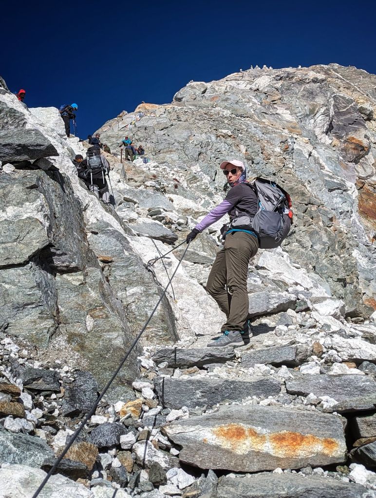

We descended 670m/2,200f in 2 hours and 20 minutes. My knees began to cry about 2/3rds the way down, but that is a hiking demon I know how to manage.

We stopped for lunch at a little town on the lip of the Ngozumba Glacier. (I can’t help you with pronunciation here, even after asking Surya to say it for me no less than six times.)

Bellies full of calories and knees somewhat rested, we debated the virtues of crossing the glacier to reach the town of Gokyo, as planned, or calling it for the day and staying here.
We both felt convinceable either way, better prepared to tackle a glacier than we had been after Khongma La, but feeling no desperate urge to press on. The afternoon clouds were coming in early, and my knees suggested maybe we would be just fine taking the restful path.
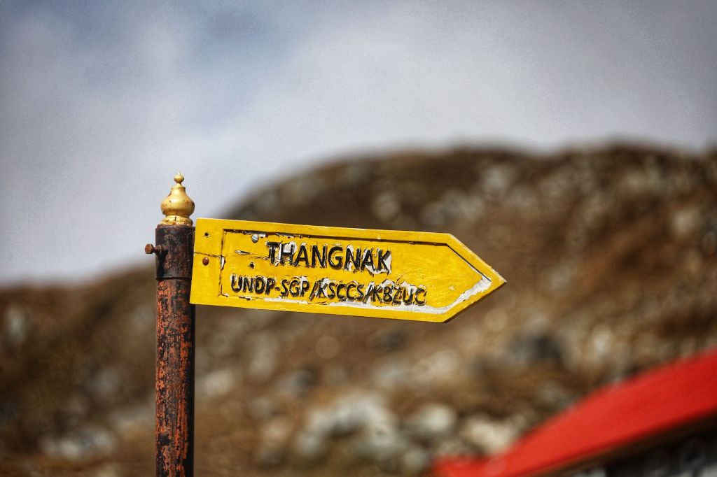
So we’ve parked in Thangnak (also spelled Dragnag – take your best guess at pronunciation) for the day. This guest house is quite wonderful, with a sunny, cheerful dining room, really clean bedrooms, bathrooms as clean as they ever get, and the tastiest dal bhat I’ve had yet on this trip. So tasty.


- Starting location: Dzongla, 4,830m (15,846 feet)
- Max elevation: Cho La, 5,370m (17,614 feet)
- Ending location: Thangnak, 4,701m (15,419 feet)
- Elevation gain: 540m (1,768 feet)
- Elevation loss: 669m (2,195 feet)
- Distance traveled: 6.5 miles in 5:29’47” active time, 6:48’12” total time
- Average pace: 50’47” per mile
- Slowest mile: 1:24’24”
Glacier day tomorrow, and perhaps a climb up Gokyo Ri for excellent Everest views if the weather cooperates. Two thirds of this trek have passed, and I’d be lying if I said I wasn’t starting to long to have my creature comforts back, but I’m still looking forward to all our remaining stops.


Nailed it.
