[To see the original journal entries recorded during this leg of our adventure, click here! But this post has all the photos. Such as there were. We spent more time suffering than taking photos, today.]
So back in the day when discussions first began regarding the possibility of us joining Hobz for one of his annual Appalachian Trail hikes, I did my level best to set appropriate expectations for all involved. Looks like it first came up in 2019, and then again in 2021 we had this exchange:

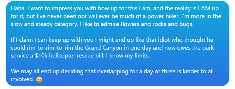
![The conversation bubbles continue:
Hobz: If you and Dustin ever want to join me for an AT section....
Laura: I ACCEPT.
Laura: Seriously. We should talk. Though we should also talk about how slow I am. [laughing emoji]
Hobz: I'm willing to adjust my pace for good company. [laughing emoji]](https://thither-yon.com/wp-content/uploads/2022/07/image-1.png?w=889)
His last comment is the only reason any serious negotiations began. Once we discovered Dustin was coming to DC for meetings in the right time frame this summer, we started working on practical details. Hobz very subtly grilled me about equipment and experience, which was more than fair. After one such exchange, I posted:
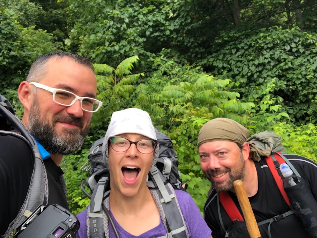
Hobz kindly reiterated that he didn’t mind going a little slower for a few days. Somehow, 1-3 days of joining him turned into 5. And then, like rockstars, we started with two really unpleasant, intense hiking days in the Smokies before meeting Hobz.
When I woke up on Monday morning, my legs barely worked. I really should have found a way to avoid running down the side of Mt. Le Conte on a bruised ankle yesterday, but here we are. My only real consolation was that Hobz, after two grueling days on the trail before us (25 miles total), was also doing a bit of gimping. Dustin, as ever, doesn’t know what any of the rest of us have to gimp about.
I stuffed my too-much food into my bag, which Hobz eyed with healthy trepidation (his bag appeared to be half the size), and we were off.

After a rolling 1.5-mile start along a gentle and lovely former railroad bed, I was feeling pretty great about this. Yeah, my bag was stupid heavy, but I was doing great! My ankle felt fine, and with all the kinks worked out of my legs, I was hardly gimping at all.
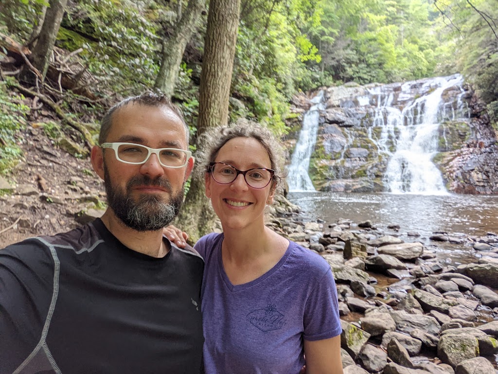
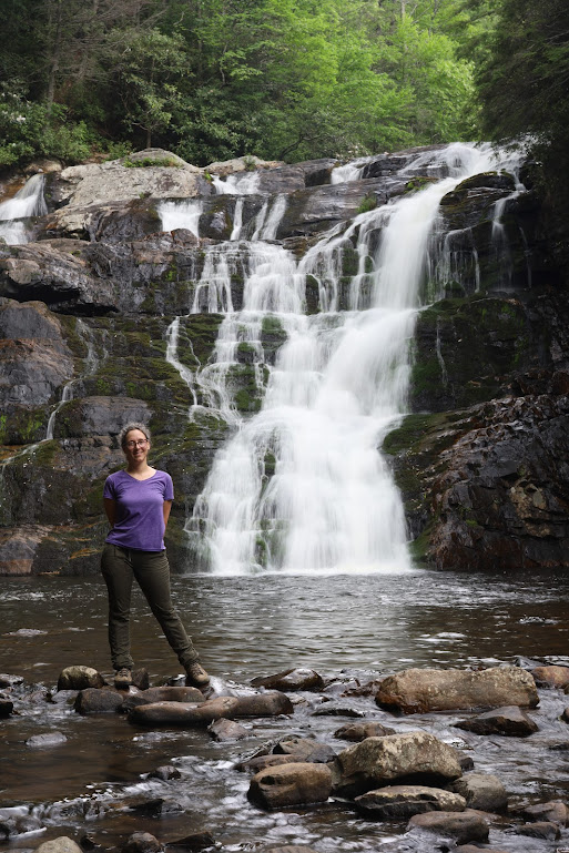
The trail took a downward turn to Laurel Falls (a different Laurel Falls – lots of laurel plants around here, and apparently no one creative in charge of naming). At the bottom, a little over 2 miles into the day’s hike, we took off our packs for a break, and it was good.

I dived into my snacks (eat the weight!!) and we took the mandatory waterfall selfies.
There was a moment’s concern that maybe we’d come down to the waterfall unnecessarily, that the path continued above and now we’d have to hike 400 feet back up, but we spotted the blaze that marks the trail in the nick of time, and continued along a path that followed the river for another mile or so.

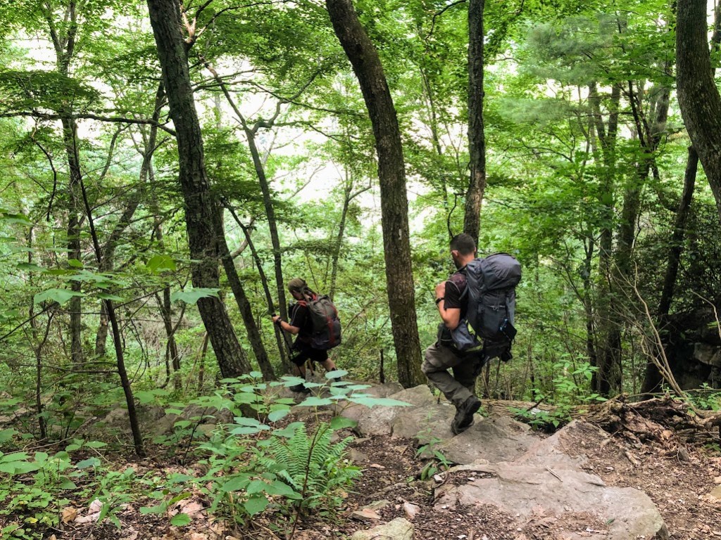
And then we started to go uphill.
Let’s talk about my heart. I have a little, tiny, hummingbird heart. At least, I assume that’s what’s going on, because NO one has a heart that runs as fast as mine does. If I’m walking, unburdened, down a shady, level sidewalk and my heartrate is less than 100, that’s pretty good! Actively hiking, wearing a normal-sized pack, in reasonable weather, I can expect to cruise along in the 140s. By the time my heart rate hits 150, I’m pretty uncomfortable and will use that as an excuse to demand a “heart break,” wherein I stand around and huff and puff until the tiny heart has come back down into the 120s.
My heart rate hit 150 within about 10 minutes of starting to go uphill in the vile humidity under my monstrous pack. I was so annoyed (and determined to prove I was not a total marshmallow) that I decided I wouldn’t call heart break until 160. That took another 2 minutes or so.
I huffed and puffed and soldiered on as gamely as I was able for about 43 miles. The only interruption that did not come at my behest was when Hobz got stung by hornets and it took us 10 minutes to recollect our party of three from the corners of forest to which we had scattered when he yelled “OOWW! RUN! OWW!! RUN RUN!!! OW!!”
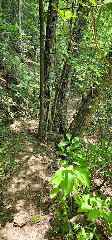
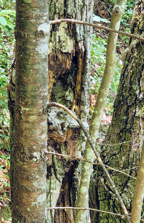
[I haven’t figured out alt text on gallery images yet, so this is for the above photos: on the left is a photo of the trail winding through some trees, one clump of trees being right on the trail. The right image is a closeup of the clump of trees, showing a hollow in one of the larger trunks. Inside the hollow is a paper hornet nest with dark spots that are probably the hornets.]
With my watch registering 7.2 miles hiked (thank gods!! only another mile to go!!) we called a break for lunch.
Hobz reviewed our progress on the trail map. “Three miles left,” he said, squinting doubtfully at the clock and then at my stupid backpack.
“Three…. whole… miles?” I whimpered. My watch is a vile traitor. I know it gives me more credit than I deserve, but this was ridiculous. I somehow managed to keep my weeping on the inside.
The good news was that the last three miles were all down hill. Well, good news for my heart, if not for my knees, who trembled but continued to support me. Mad about my stupid pack and my stupid pace, I kind of flung myself down the hill, managing three sub-30-minute miles (“miles”) to round out the day.
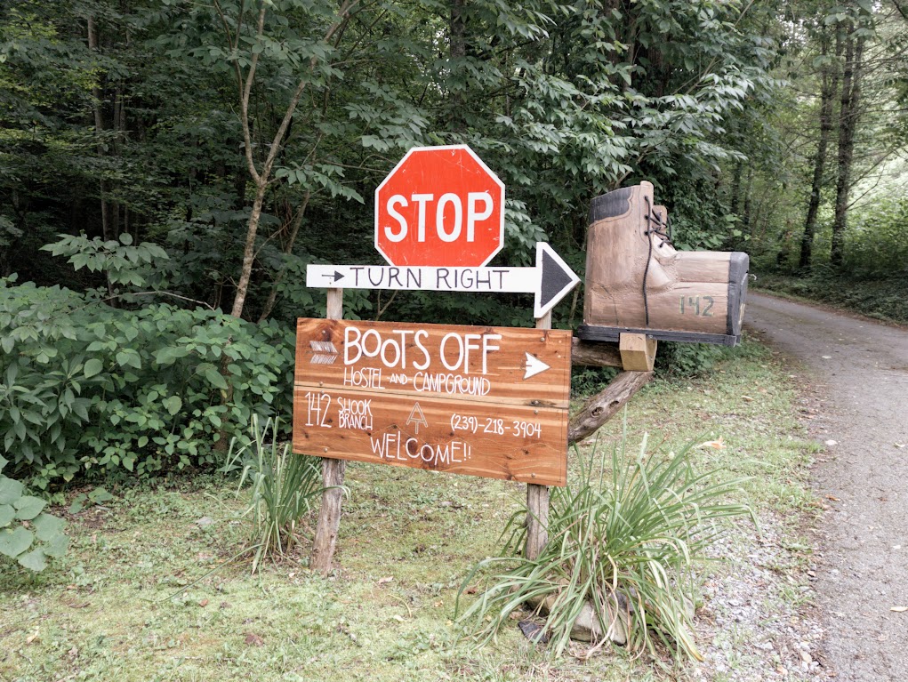
We stumbled into Boots Off Hostel after 5:30, making for nearly 8 hours out on the trail today. Even if only 6 of them were spent actively hiking, that’s ridiculous.
“I’m a little worried about our plan for tomorrow,” Hobz said after dinner, trying to be tactful. The 8-mile day had been a tiny day, designed to start us off slowly, to help us get our feet under us. Day Two was meant to be 13 miles, and nearly twice the elevation gain.
“I’m not worried,” I said jauntily, feeling better for having had a really great shower and a pouchfull of calories, “but let’s talk about back-up plans!” I meant to stay positive, but I knew I needed to be realistic. I’d really sucked up today’s hike. Two pounds of my food lay abandoned in the Hiker Box, plus whatever we’d eaten today, but it didn’t feel like much of a dent.
We identified an available shelter a little more than 9 miles into tomorrow’s hike, as well as locations where the trail crossed the road in case my heart or legs or spirit totally crapped out on me and I just needed to call Lone Wolf and go home.
“I mean to hike all 13 miles tomorrow,” I concluded, very sincerely, “I just want to have the bases covered.” I’m a big fan of backup plans, which is both a strength and a weakness. If I didn’t love backup plans so much, I wouldn’t have brought food that needed to be abandoned.
(Photo credit: Hobz)
DAY THREE STATS
- Trail Map Says: 8.4 miles (cumulative: 24.5)
- Laura’s Watch Says: 10.72 miles (cumulative: 29.51)
- Cumulative Elevation Gain: 2,042 feet
- Elevation Loss: 2,598 feet
- Start Time: 9:42am
- End Time: 5:36pm
- Active Hiking Time: 6:14
- Average Pace: 34’54” (best: 23’33”, worst: 52’02”)
- Average Heart Rate: 104bpm (peak 166bpm)
- Calories Burned: 2,954
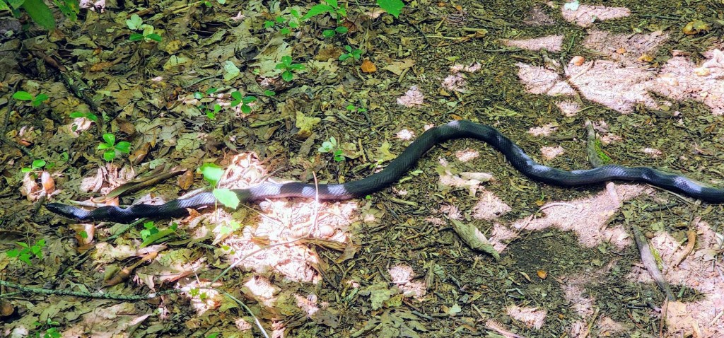
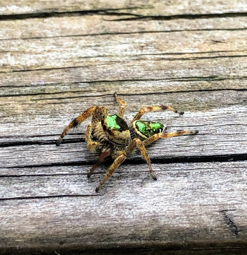
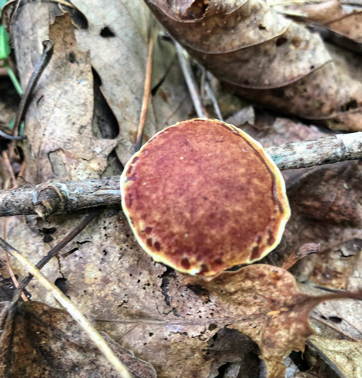
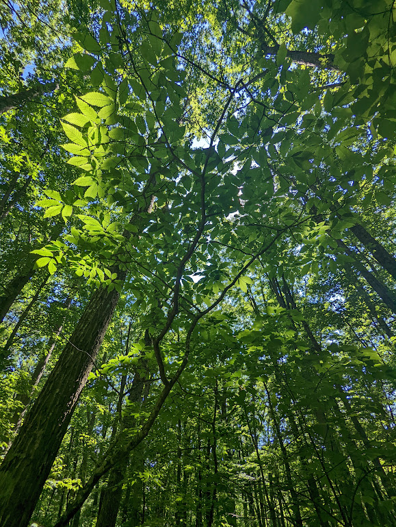
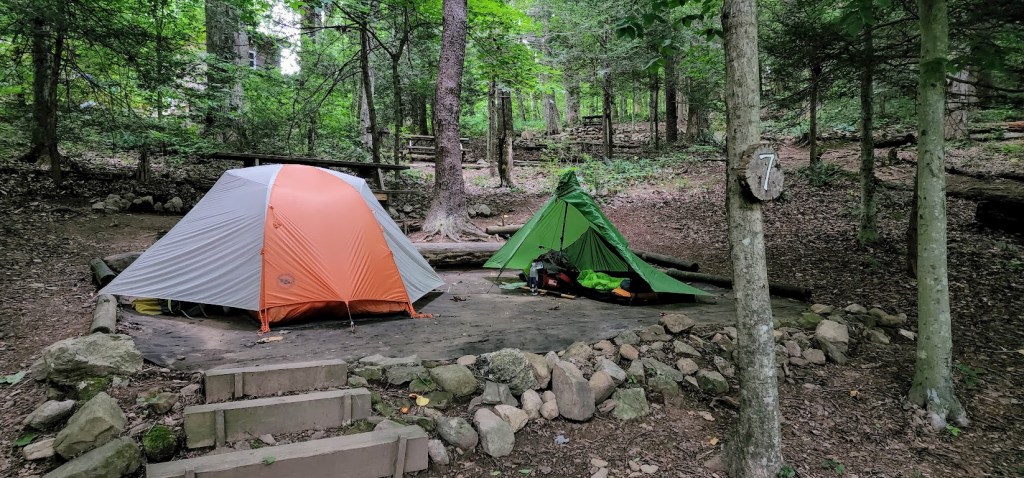
And a little trail photo-candy to wrap things up: