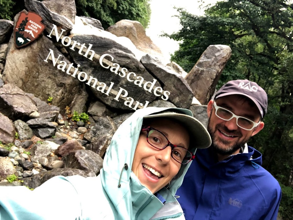
“North Cascades is on fire,” Dustin said as we tucked ourselves into bed on the first of our two nights in Seattle. Sleeping in a hotel two nights in a row was a delicious, expensive luxury, and we were enjoying the heck out of it. I’d taken a lengthy bath and we were now deep into our third hour of TV. I pulled the mid-grade sheets up to my chin and wiggled happily around in them.
“How on fire?” I asked. “On a scale from zero to Lassen?” Lassen National Park, which we’d visited barely two weeks before, was currently being devoured by the Dixie Fire. Fires all over the country were choking the summer air with smoke. These sheets were so not-a-sleeping-bag, though, I was having a hard time taking a new fire very seriously.
“The fire is east of the park,” Dustin said, “but it looks like they’re starting to evacuate those communities.”
I grunted. Evacuations meant the fire was much closer to the “Lassen” end of the scale. I scooted out of my sheet burrito, turned down the volume on a rerun of Futurama, and pulled my phone out to learn more.
“Oh no!” I said a moment later. “That’s by the eastern park entrance. Two of my top-pick hikes are right there! This’ll ruin the views, and the views are the whole point!!”
“A lot could change in the next three days,” Dustin pointed out. “Let’s just see how it looks tomorrow.”
TOMORROW
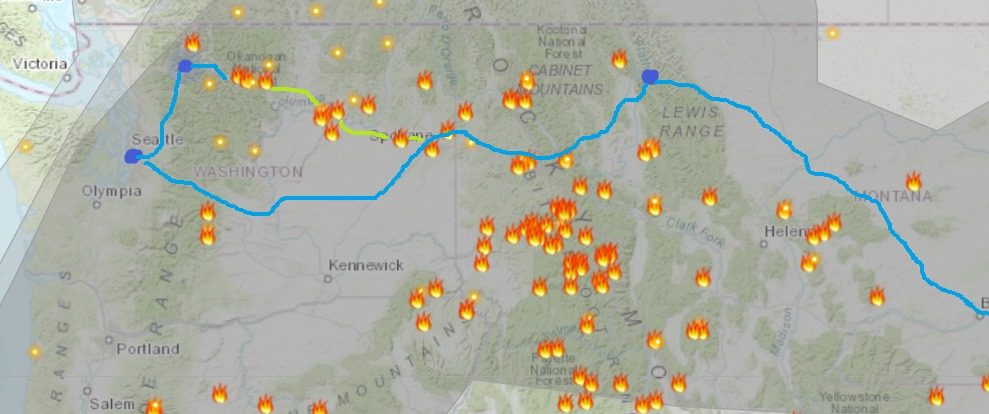
“They’ve closed the highway out of the park,” I reported. “Google Maps now says it will take us 9 hours to drive to Winthrop.” Winthrop was the town east of North Cascades where we had a reservation after our last day in park. The drive should have been about 90 minutes, but now we’d have to leave the park out the west entrance, drive back through Seattle, and come up to Winthrop from the south. Not (strictly speaking) a very practical plan.
“That’s a terrible plan,” Dustin said, upping the adjective ante. I glared at the road-closure icons on my map, as if I could shame them into revoking themselves.
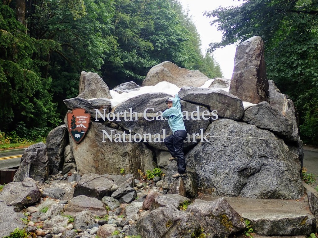
There are, however, no other roads going east out of North Cascades. It is one of the most remote national parks in the country, with the closest towns in any direction being at least 60 miles out. The only option that didn’t involve driving the extra 9 hours was “skip North Cascades.”
“No, let’s not skip it,” Dustin said. “We’ll follow our plans for the first two days, then see how the fire looks. Best case scenario, we can go through to Winthrop. Worst case scenario, we cancel the hotel reservation and come back down through Seattle. If we don’t actually have to drive UP to Winthrop, the extra time on the road isn’t THAT much.”
(This is why Dustin is the driver. An extra 2.5 hours seems like an awful lot to me.)
We pointed the car north and chugged along through the deep, dark smoke.
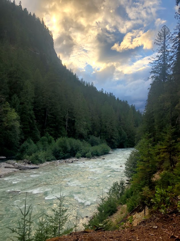
Actually, now that a fire was trying to derail our plans, the skies seemed bluer than they had in days. Weeks, maybe. Some puffy clouds – another oddity – kept pace with us as we wound our way through scenery that just kept getting more beautiful.
As we passed the last outposts of civilization at Rockport and Marblemount, the clouds began to look a little more sinister.
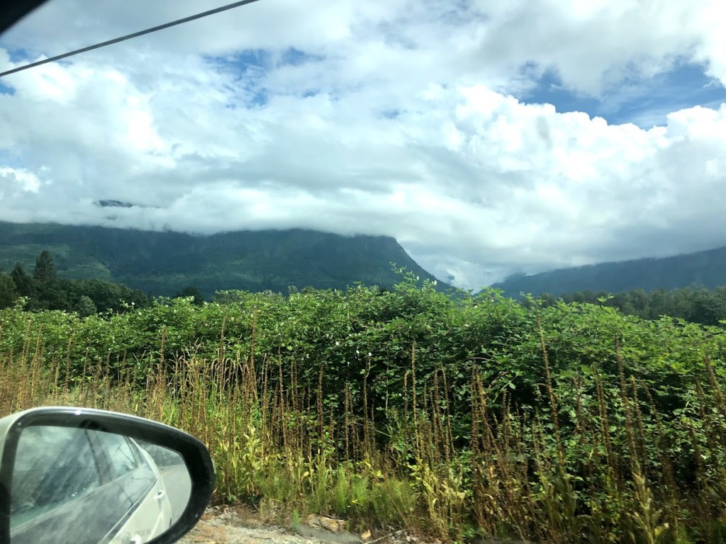
“I think those are mountains out there?” I said. I didn’t feel too cross about their tops being lost, though, because at least the air felt clear. And if it decided to rain on the fire that was in my way, well…
Per my blindingly brilliant and specific plan for the day, we reported to the Wilderness Information Center to inquire about a campsite.

The conversation started like this:
Me: So the internet says the Sahale Glacier campsite might still be available, and I was thinking maybe we could reserve this one at the bottom of the hill for tonight and Sahale Glacier for tomorrow?
Dustin (not actually out loud): You have a problem.
Ranger: That’s true, but unfortunately the road to the trailhead has washed out, which means there’s an extra three mile hike to even get to the trailhead.
Me: [silent while I contemplate the loss of another glacier versus the obvious idiocy of adding three miles to an already long hike]
Dustin: It’s 3:00. Maybe we shouldn’t do that? Besides, the clouds are like, twenty feet above the ground. We wouldn’t get much of a view.
Ranger: And you’d have to wade across the stream that washed out the road. Well, it’s more like a river right now.
Me: Okay okay! We won’t hike to the glacier.
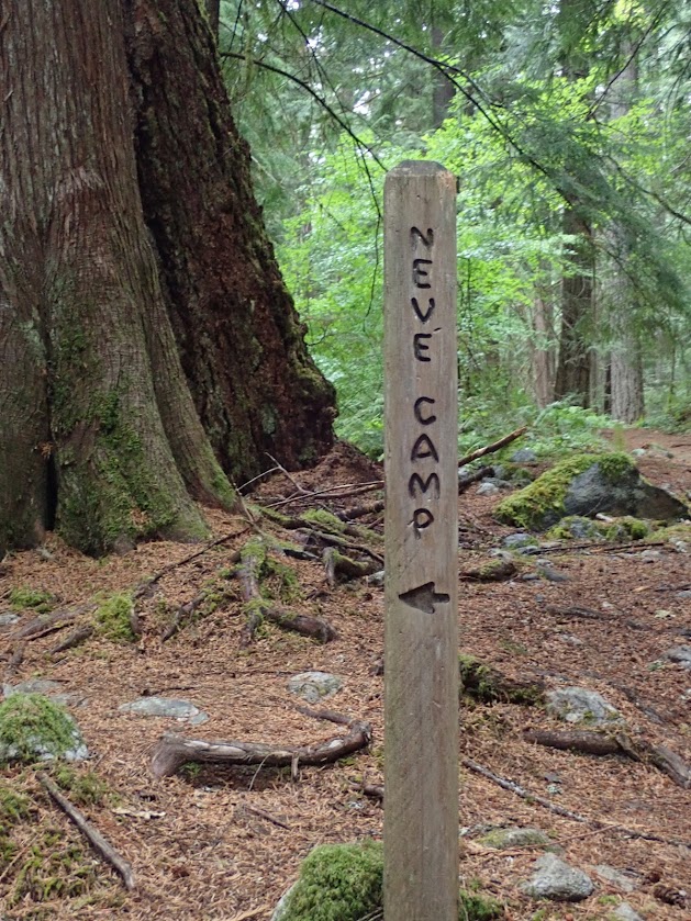
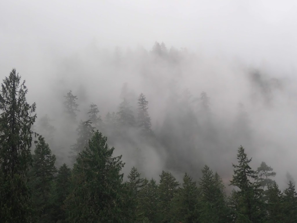
A large quantity of negotiating later, we settled on Neve Camp, a friendly 3.7-mile hike down the Thunder Creek Trail, with the option of doing an uphill spur up to see the views at Fourth of July camp if the spirit moved us (and the clouds).
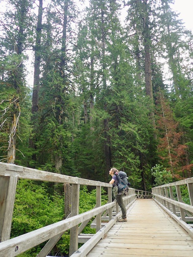
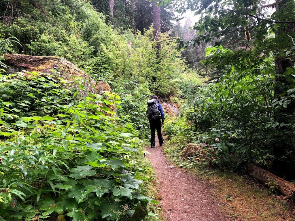
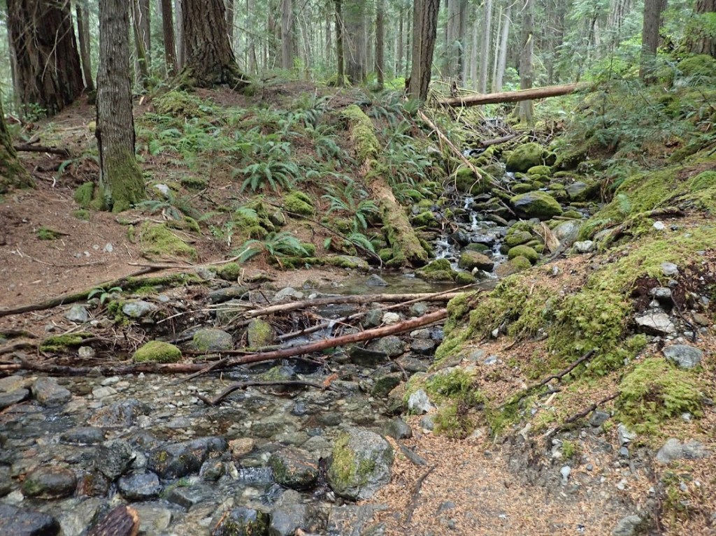
I’d had big dreams for hiking at North Cascades. North Cascades has the highest concentration of glaciers of any national park in the lower 48 – even more glaciers than in GLACIER National Park. I wanted to get my grubby hands on all of those glaciers. I’d known it might not be easy, or the camp sites might not be available, so I’d come up with a couple backup plans:
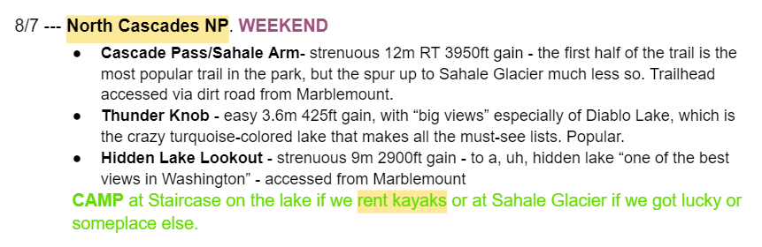
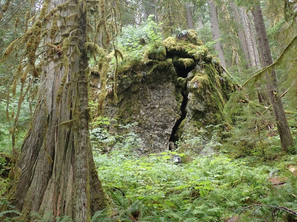
Every one of my plans, however, had assumed there would be visibility above twenty feet. I’d been prepared for forest fires and summer thunderstorms and maybe a cloud or two of locusts, but not the limited (but stunning) view that waited for us upon waking the next morning.
The rain started in earnest about two minutes before we got back to our car. Having already come to grips with the lack of glaciers, the thoughtful timing of the rain felt worth celebrating. We decided to celebrate by eating peanut butter sandwiches in the car.
While we ate, we mused about where we would sleep.
“We’re not going to hike out to another backcountry camp tonight, are we?” Dustin asked. It wasn’t actually a question.
“But the nearest hotel is an hour out. If we go out that far, will we want to come back tomorrow?”
“Let’s check the frontcountry campgrounds,” Dustin said. “I bet we won’t have a lot of competition today.” The rain continued to pour down outside, but neither of us was ready to be done with this park yet, soggy or not.
“We do have a very good tent,” I agreed.
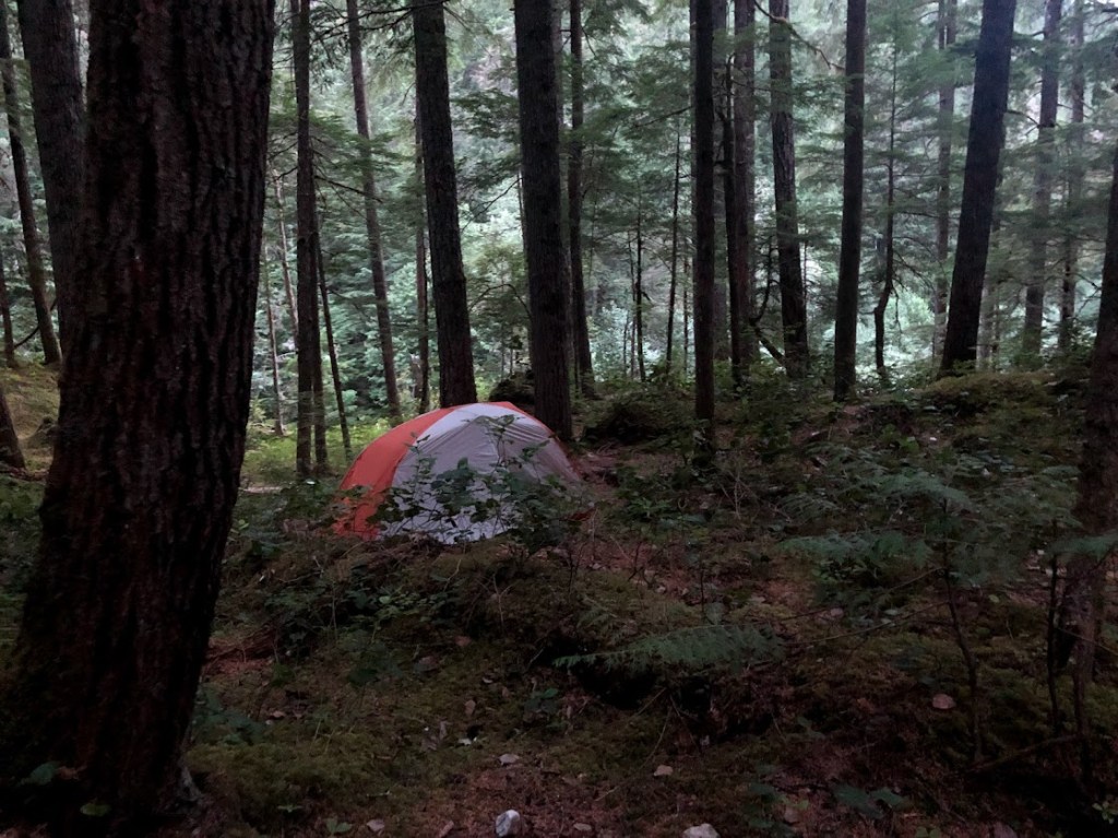
We pulled into the Goodell Creek Campground because it was the first we came to. Deep contemplation was not required to figure out that an awful lot of people had canceled the weekend plans when the rain set in. The campground was wide open, and so we took a little time to choose a lovely site. In fact, they were all lovely, with a great deal more privacy than we’d enjoyed at the Staircase Campground in Olympic.
As we pulled our car into our selected site, the rain sputtered to a stop. We looked at each other with raised eyebrows. We’d been mentally rehearsing how to set up our tent in the rain while getting the fewest things drenched, and now…
“GO GO GO GO!”
We set the tent up in record time, including filling it up with all our frontcountry comforts, like actual pillows and extra padding.
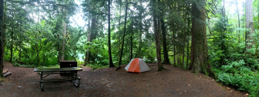
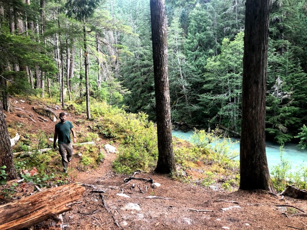
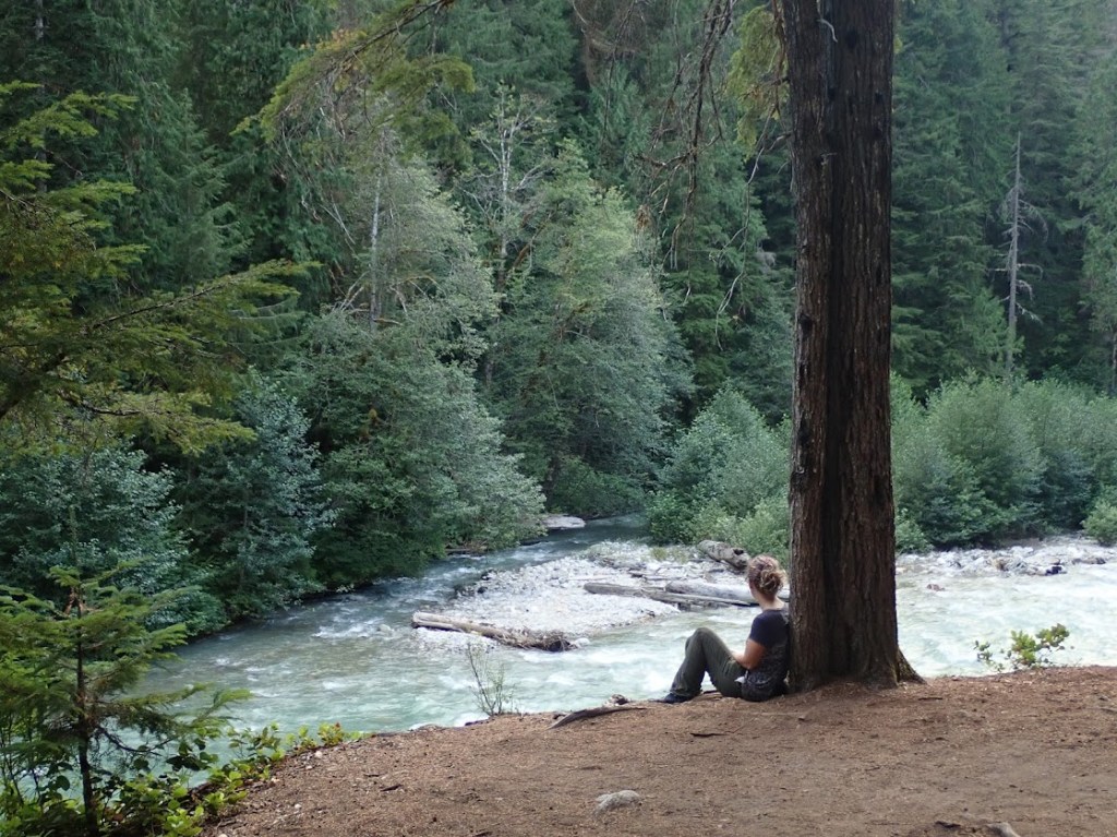
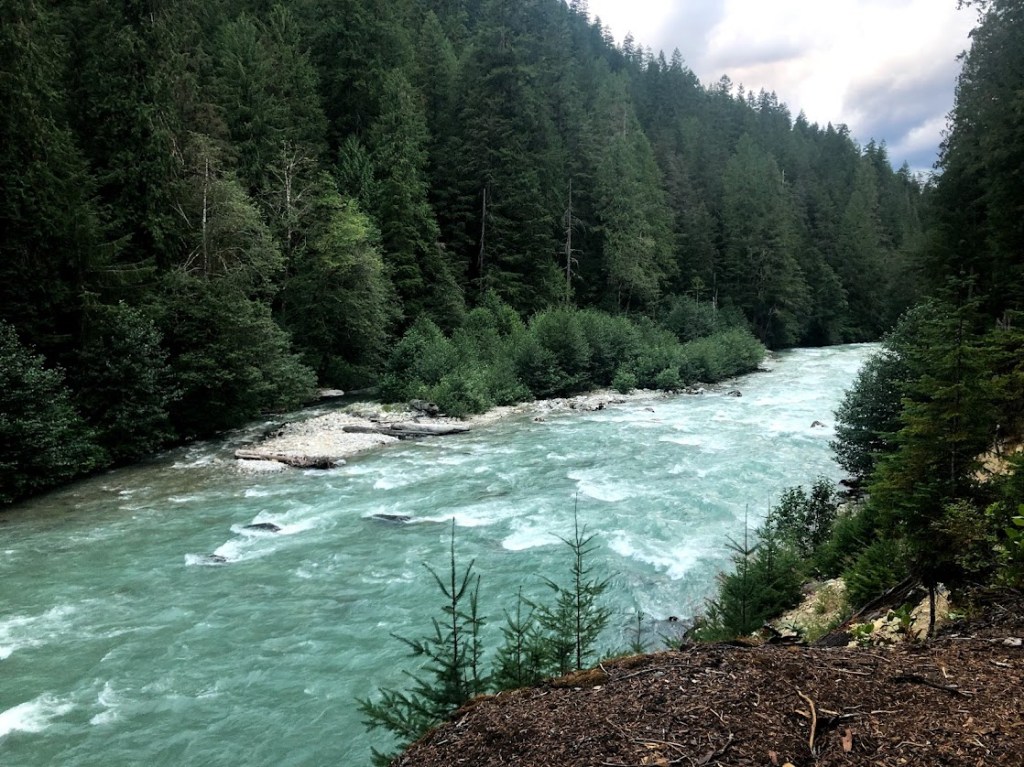
Our site nestled on a little hillock which dropped off to the Skagit River less than twenty feet away. In the photo above, you can pick out the river as a bit of turquoise behind the trees.
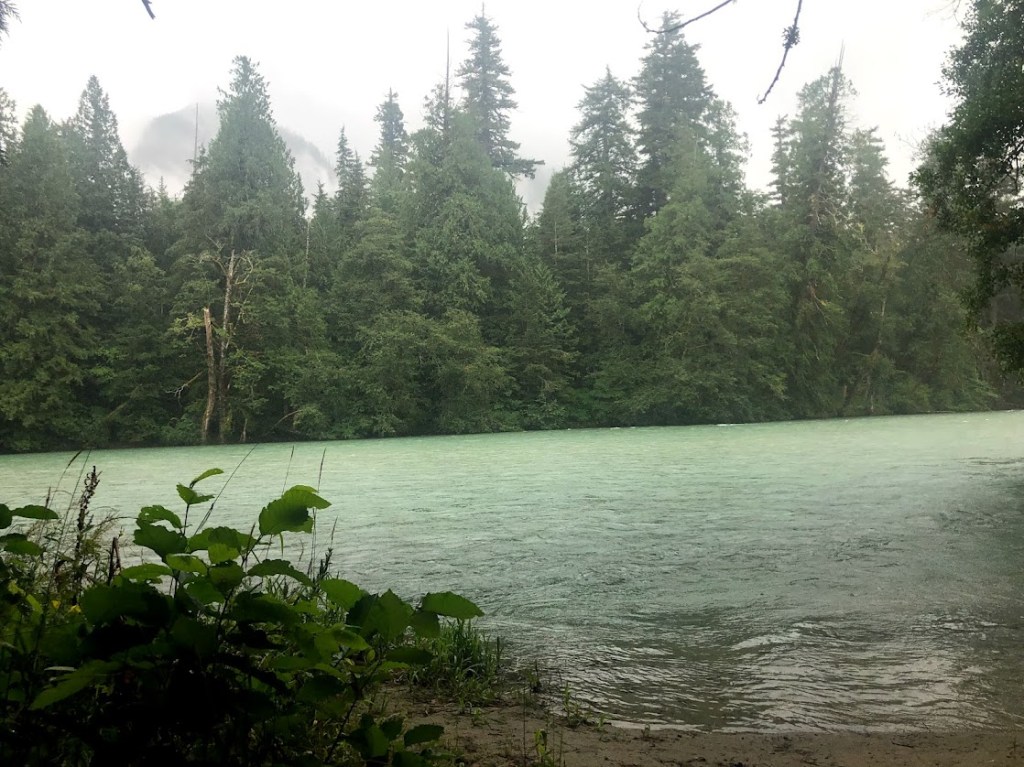
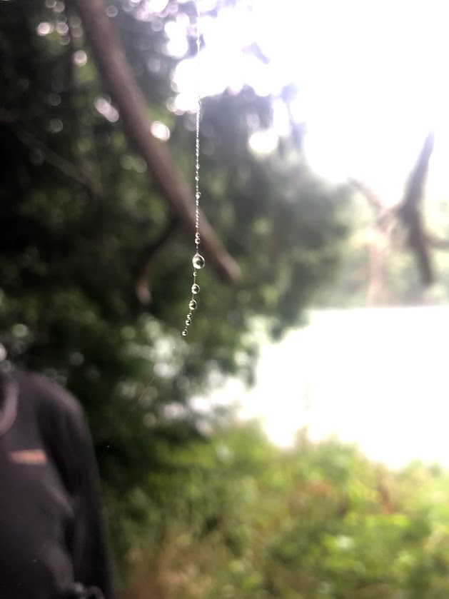
Our campsite might once have had its own private beach, but today the beach had been eaten up by a river that was certainly swollen, if not properly flooding. I took a minute to admire a lovely abandoned spider web –
– and then the rain started again.
We hopped into the car to consider our options.
“We made the effort to set up shop out here,” we agreed. “Might as well hike.”
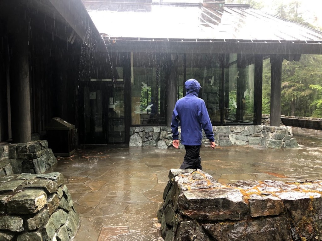
And so the true test of our rain gear began.
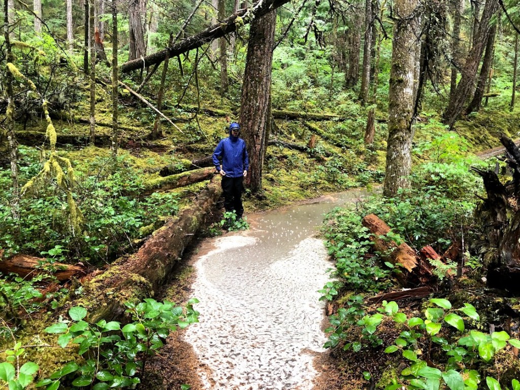
The trail we’d chosen was a network of paths looping between the campgrounds, the river, and the Newhalem Visitors Center. The rangers were, needless to say, impressed by our dedication.
Having looped back to our tent site after a few damp miles, we retreated once again into the car and eyed our bag of bread warily.
“Marblemount has a well-rated diner?” I proposed.
“Well rated by starving wet hikers, or by normal people?” Dustin asked, but was already pulling the car out onto the road.
I keep saying there are “no towns” within 60 miles of the park, and depending on your definition of “town,” that is true. Marblemount is a small collection of buildings about 10 miles outside the park’s west entrance. Two of them, as it turned out, served food to soggy campers. We wound up at Mondo’s Cafe, where the burgers got bigger and bigger the farther down the menu we read, then all the sudden there was a surprise section of Asian dishes. I ordered bulgogi and it was delicious. Starving-wet-hiker delicious for sure, but maybe also just plain delicious.
Harken back to that tent we’d pitched earlier in the day. Remember it?
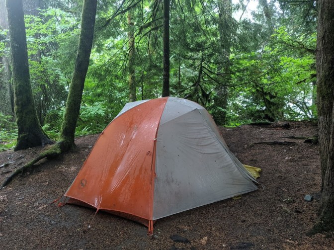
We pulled back into our camp site around 8:30. The night was already very dark, but in the flash of the car’s headlights, we could already tell something was wrong. We sat in the car, staring at our tent in bemusement for a few silent moments.
“Huh,” one of us finally said.
Our tent sat in the middle of a perfect circle of standing water, as if it had decided to grow its own moat. It was perfectly centered. I judged the moat’s depth at about two inches.
“So what’s the strategy, then?” I asked as the rain continued to pour down.
The strategy, simply put, was “run and dive.” (Into the tent, not into the puddle.) It might have been a little more complicated than that in practice, but the final result was quite good. We got ourselves into the tent and brought very little wet along with us. Coats got left in the car, boots got left under the rain flaps.
I sat in the tent and tentatively examined the floor under the light of an LED keychain. It was mysteriously, marvelously dry. It felt a bit like we’d set up shop on top of a waterbed – the bottom of the tent rippled when prodded – but all the water remained on the correct side of the plastic.
“I think it’s gonna be okay!” I said. I felt like a little kid playing fort, except this time my fort was really, truly watertight.
As I drifted off to sleep, I composed “Ode to Big Agnes” (Big Agnes being the brand of our tent). It was a lovely poem, metered and very witty. I praised her for being oh-so-watertight, despite our folly. By the time I woke up, only the memory of my brilliant composition remained, with none of the specifics still attached.
The enduring love I felt for my tent by the next morning didn’t exactly mean I spent an easy night. I woke up several times throughout the night to pat the bottom of the tent (squish squish squish). It surprised me every time to find it still dry.
By morning the rain had let up and our moat had drained away. Impossible as it felt to believe, though, the fire still raged outside the park’s east entrance, and we would not be getting to Winthrop after all. At least we would not have to hike out of a backcountry campsite with wet gear on our backs.
I waved at the hidden glaciers as we pointed the car south and prepared for a mad-long drive to Glacier with a capital G. “You can’t hide from me forever,” I promised. “We’ll be back.”