Mount Baldy Quick Stats:
- Map Miles: 2.2
- Laura Miles*: 3.07
- Trail Type: out-and-back
- Elevation gain: ~600 feet
- Difficulty: the trail is moderate, but the rock scramble at the end is only technically not rock climbing
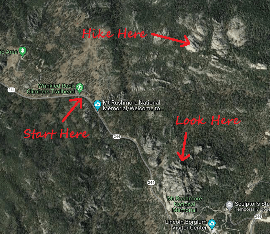
- Trailhead: Wrinkled Rock Climbing Area
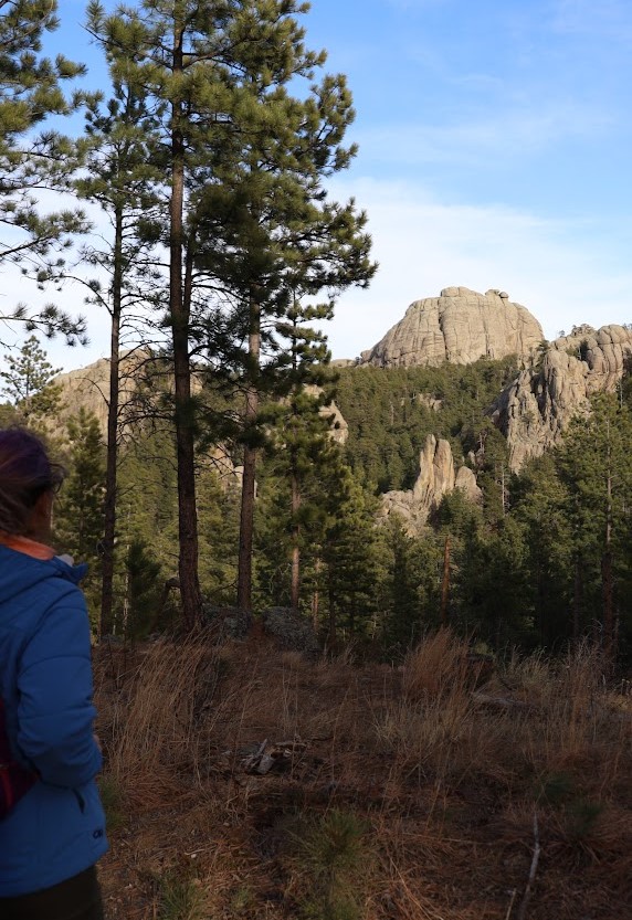
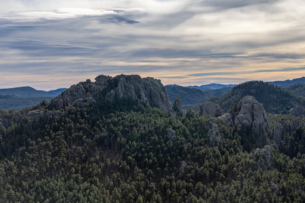
- Why bother? See incredible views of the Black Hills, including the back of Mt. Rushmore; watch the wild rock climbers at play; admire gargantuan granite formations that make you feel tiny; climb a seriously prominent peak and earn a badass hiker badge;
Just another 65-degree day at the end of November in South Dakota’s Black Hills. We’ve nearly exhausted all possible jobs to do in the yard, so I guess we’ll just have to go out for a hike.
Dustin is our trailfinder, and today he used my guidance of “we haven’t been to the southern Hills for awhile” to locate the hike up Mount Baldy.
“Haven’t we already done that?” I asked.
“No, that was Old Baldy,” he said. “In the northern Hills.”
Old Baldy was the infamous six-mile hike we finished in 11.5 miles because we accidentally followed the route signs set up for the mountain biking competition that had happened there the day before. It would have been 20 if we hadn’t given up and turned around when we encountered a farmhouse that we 100% hadn’t seen on the way up.
“Oh good,” I replied. “I don’t think I need to do Old Baldy again.”
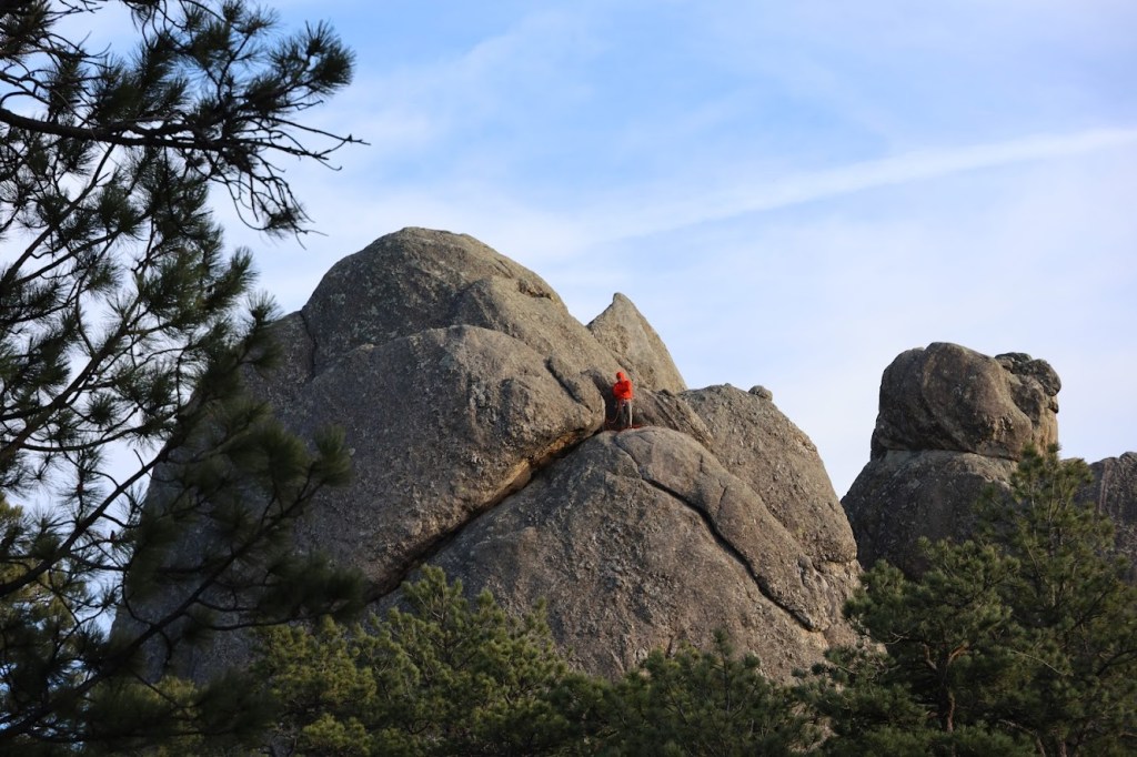
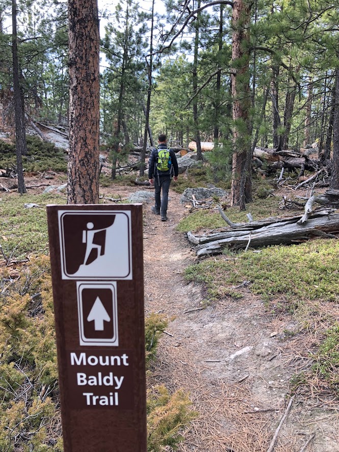
The Mount Baldy Trail (also called Old Baldy Mountain Trail, just to keep things good and confusing) starts at the Wrinkled Rock Climbing Area pullout off Highway 244, just past Mount Rushmore. As the name suggests, it’s a very popular spot for climbers, and the parking lot can get full on nice days, so consider an early start. Even at the end of November, half the parking lot was full.
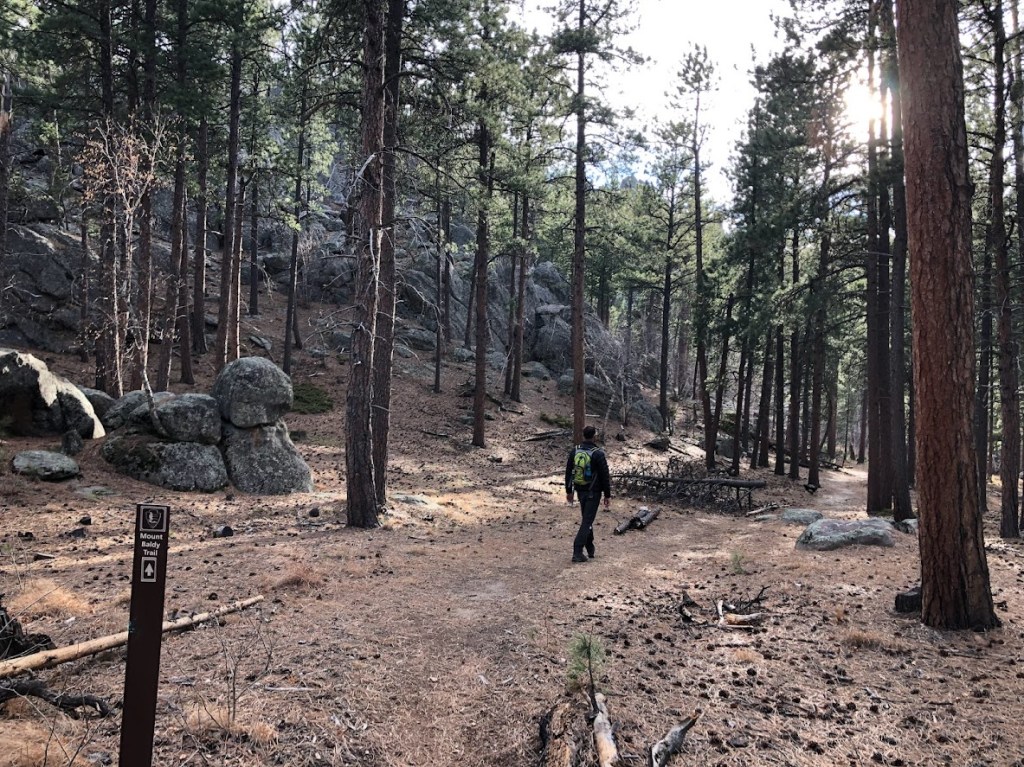
The trail starts on the east side of the parking lot. Right away, the trail branches out into a whole maze of paths leading to various rock ascents. Definitely bring or download a good map and don’t rely on the vague directions in this post. The good news is that once you get past the climbing area, the trail is very well marked.
First, though, you’ve got to go down. Pass all the climbers (wave as you go by, but don’t try to poke or feed them) and begin rolling down the hill, through the beautiful pine and aspen trees. You’ll drop about 150 feet of elevation here. Don’t worry – you’ll get it back!
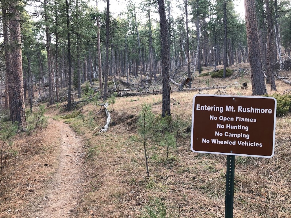
Once you reach the bottom, you are officially inside the boundaries of Mount Rushmore National Memorial. This means all the regular rules from national parks apply, namely: don’t do the things the sign says not to do, don’t take anything you find, and don’t be a jerk. Actually, the last one applies universally.
Even the trail signs want to make sure you know this won’t just be a stroll in the park – though parts of it really are a lovely stroll. The trail itself isn’t heavily trafficked, so it can be a little unclear in places. Keep your eyes out for the next trail marker – there’s almost always another one in view as soon as you pass the last one.
Until you get to this rock.
The sign says, “Mount Baldy Trail” and points at this rock, but from here, you’re on your own. Your primary directive is “up.” Just keep going up.
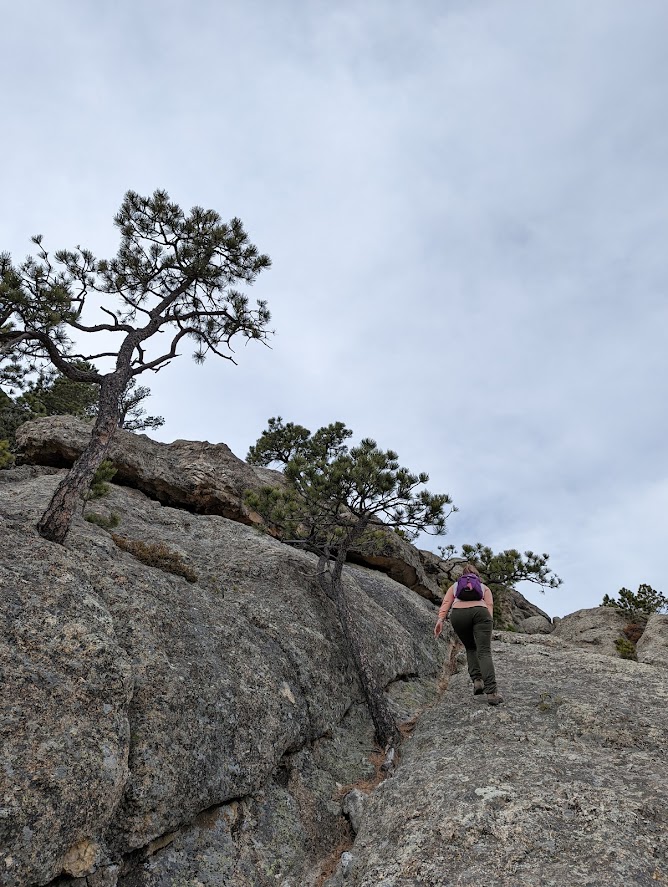
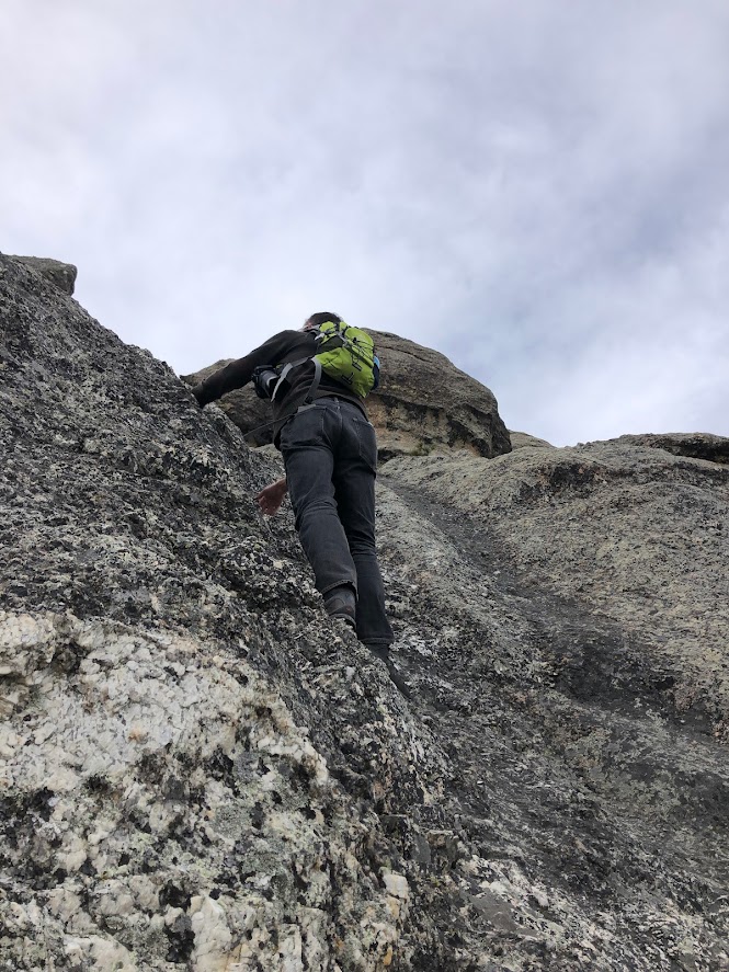
Sometimes going up will look a lot like rock climbing.
Sometimes you’ll find a smoother way that you can nearly walk up like a normal person. Assuming you remembered to wear your really grippy boots.
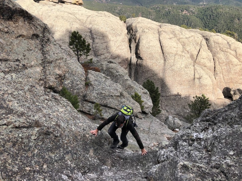
Sometimes, you will think you made a good choice, and then you will turn around and go look for a better choice.
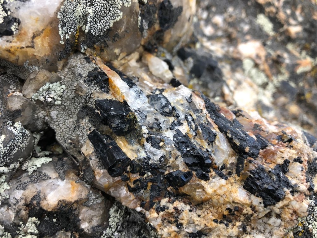
Sometimes you will see a really beautiful rock that you have to pause and take a picture of, heedless of the glorious view just behind you.
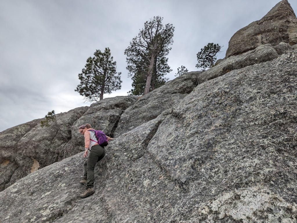
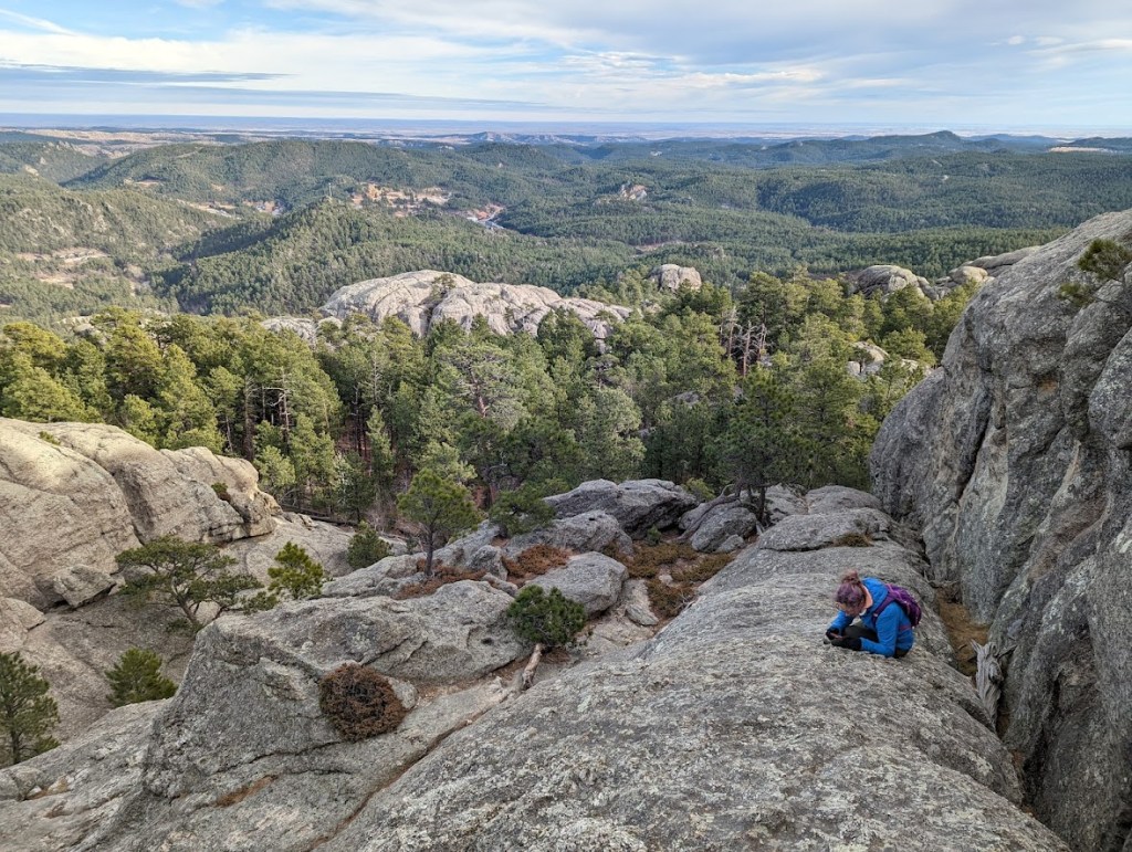
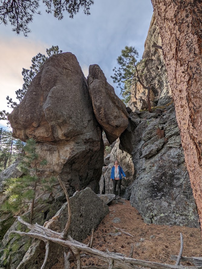
After a reasonable bit of scrambling, we arrived on this lovely flat area feeling like mice who had just solved a maze. We didn’t know it at the time, but this flat area was the last moment of calm we would have on this hike (and by “calm” I mean “free of gale-force winds”). Stop and rest here if you need a breather. The views are already pretty spectacular.
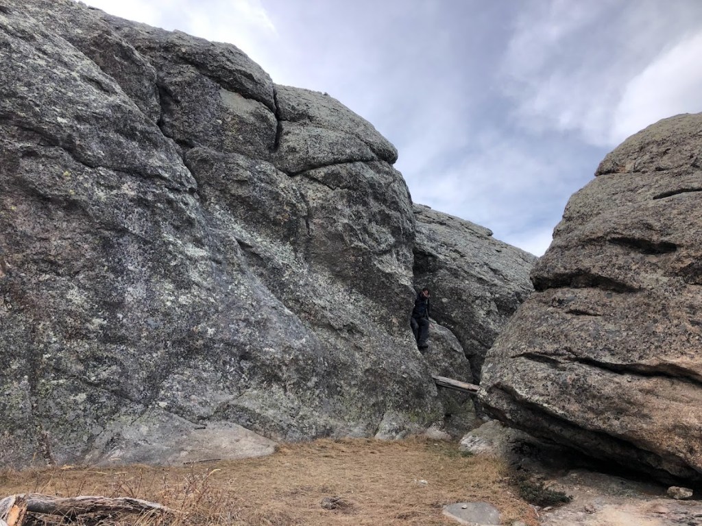
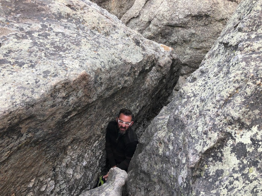
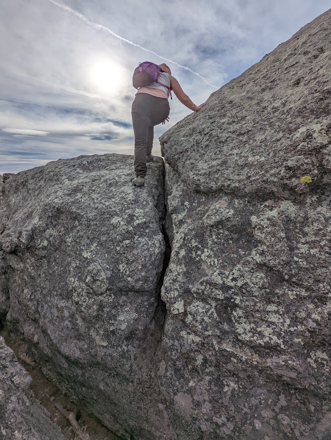
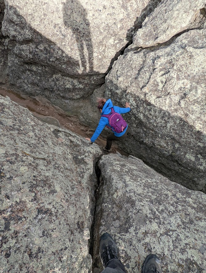
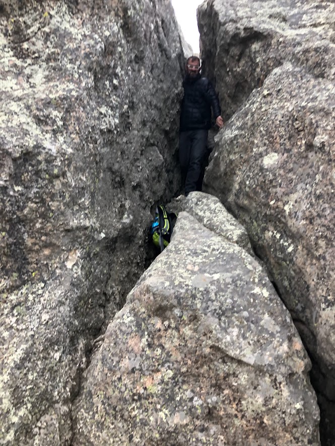
“Now what?” you may be wondering, as you look around. The rocks here are all nearly vertical, and if we’d been “nearly climbing” before, it appeared that real climbing might soon be necessary. I gravitated toward the lowest section of rock, where a convenient tree had fallen to provide a footstep. Look at that photo above, again. See Dustin there? That’s where you’re going. We’ll zoom in a little:
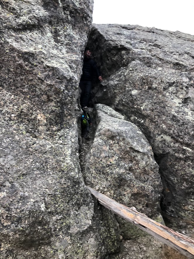
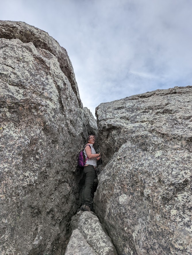
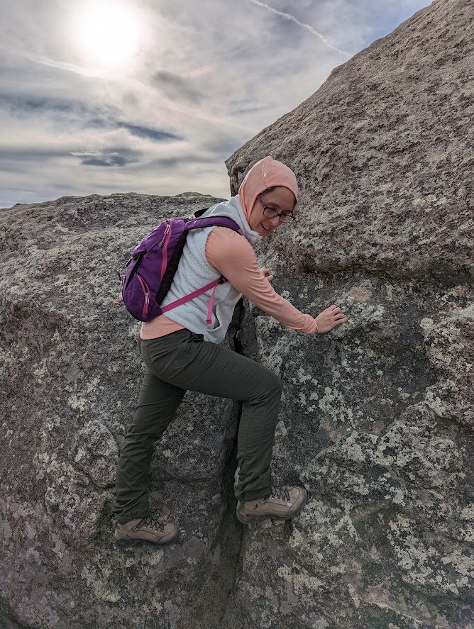
There’s a crack in this rock. It isn’t a very big crack, but it was big enough for me in my daypack and for my 6’3″ husband after he took his daypack off. Larger hikers or anyone who suffers from serious claustrophobia might need to see about picking a route over these rocks instead of through them. I, myself, am strange and unusual mildly claustrophobic, but managed to navigate the squeeze without any serious pangs.
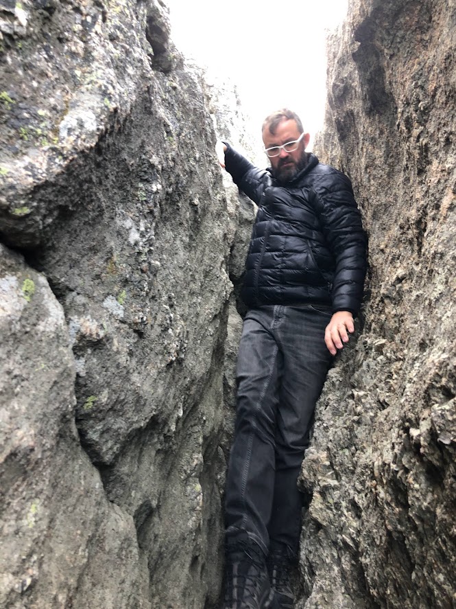
And Dustin didn’t tear his new puffer jacket.
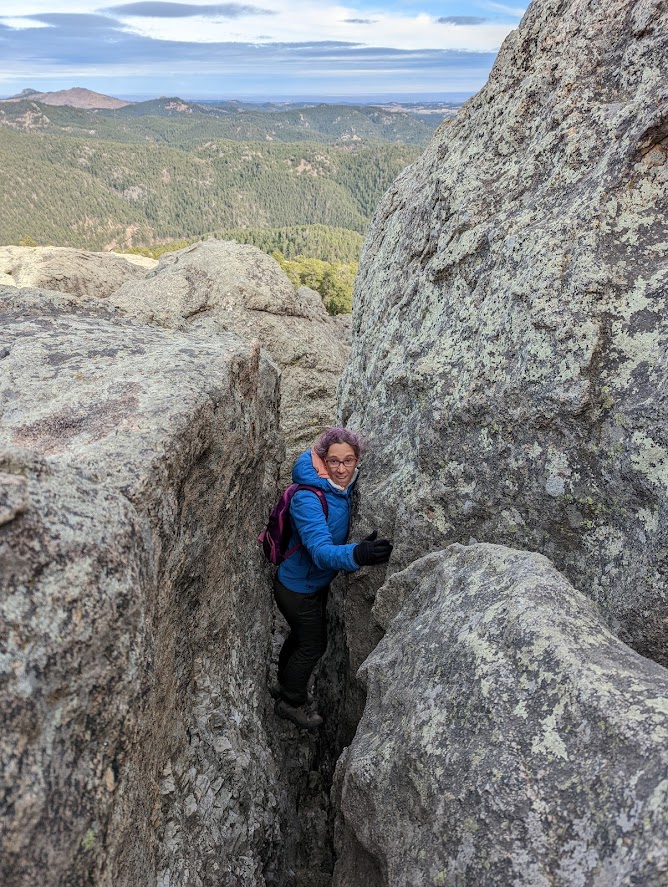
I tried to cheat my way out of the crack. It didn’t work.
Rock crack hipster.
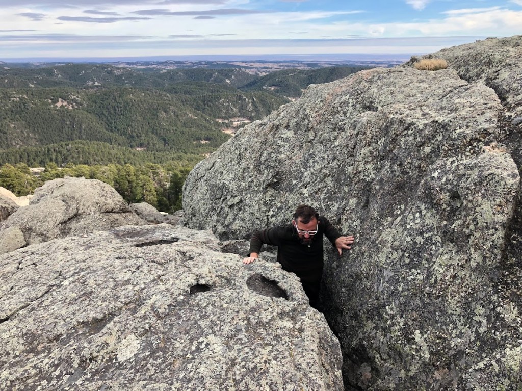
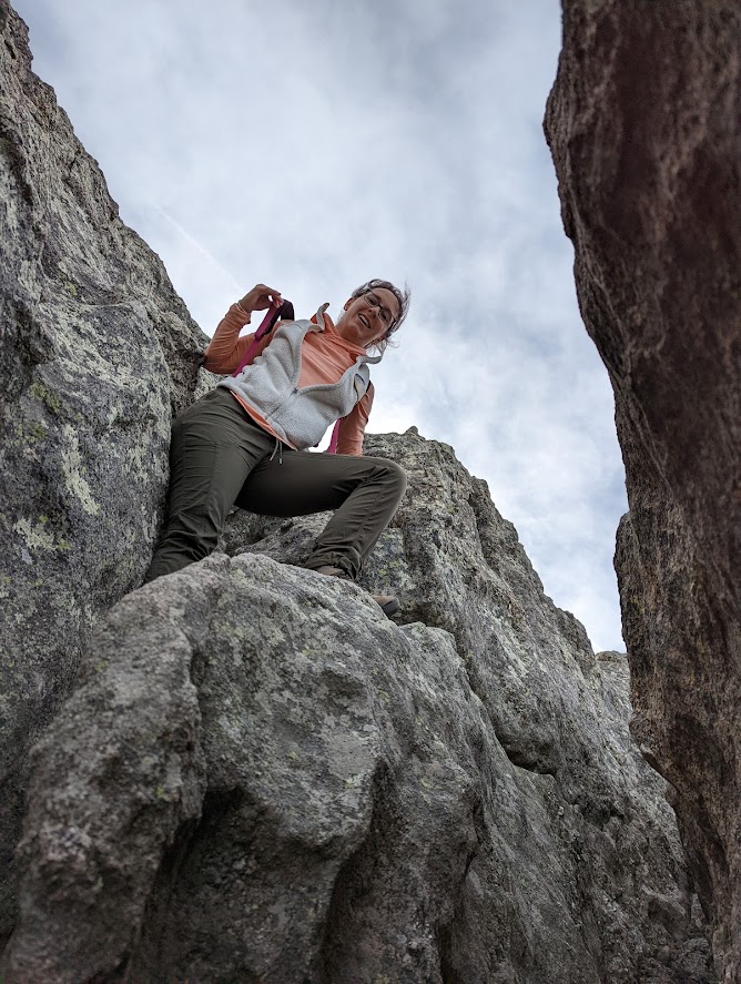
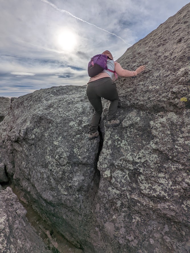
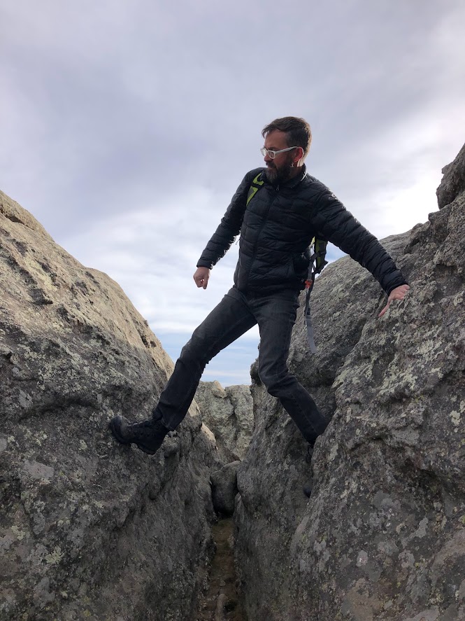
Victoriously emerging from the crack! But there are more rocks to go. From here, it’s mostly picking your way carefully over the uneven boulder surfaces, but if you want to make it to the very bald top, there’s at least one more bit of climbing to navigate.
Ope, there we go.
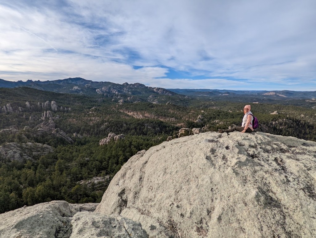
And then suddenly, the top! It’s not hard to understand why this rock (and so many others) is named Baldy. It’s a big, naked, rock pate with a serious view in all directions.
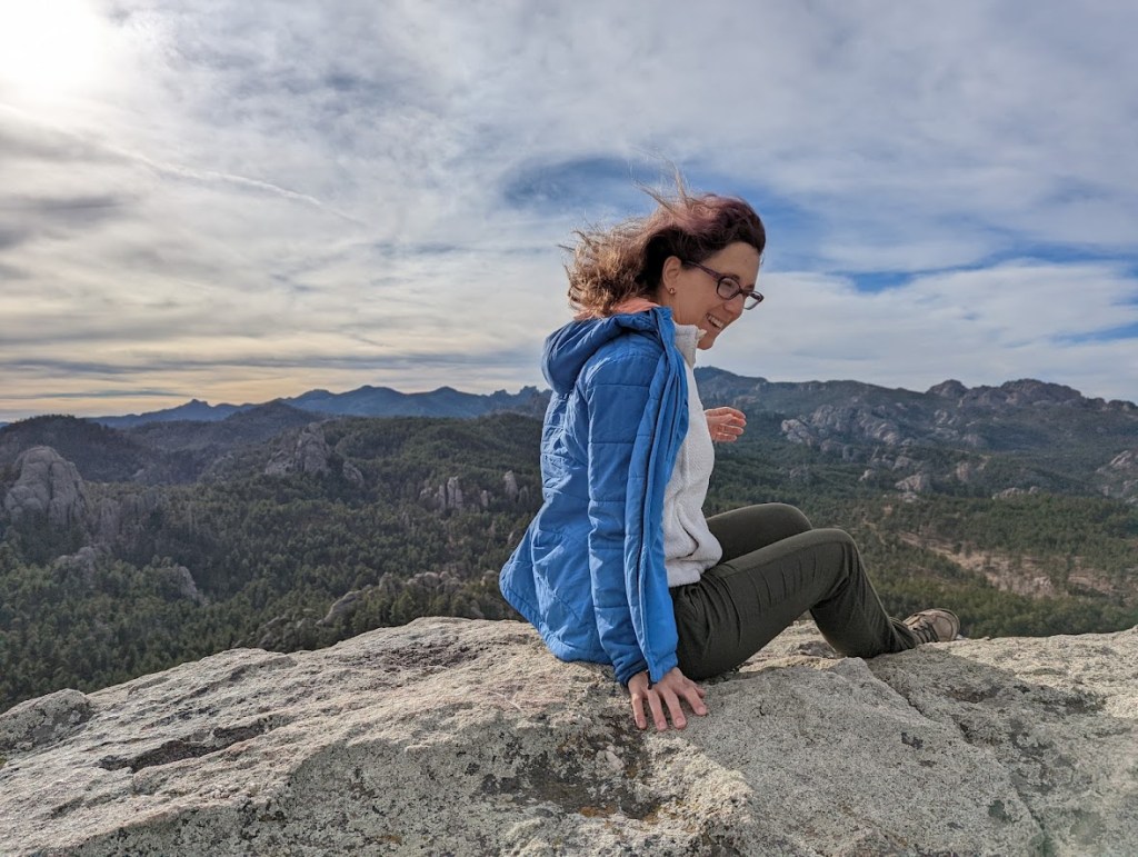
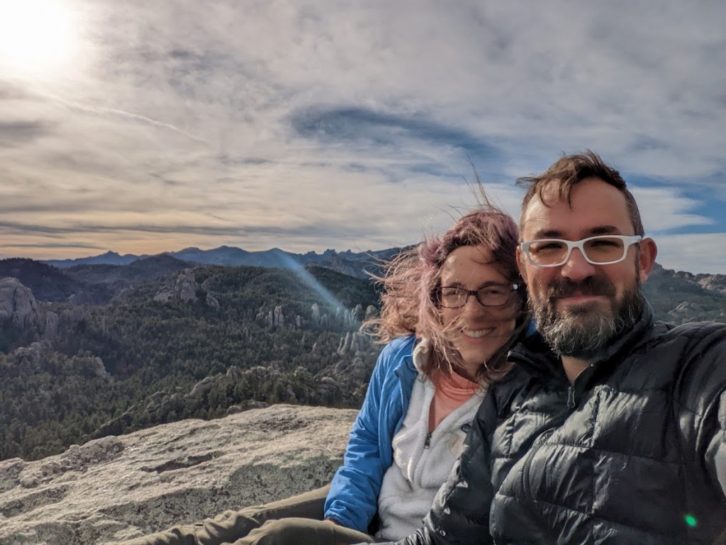
Even though I set my hair free for effect, it’s hard to understand just how windy it was up there. An unexpected gust knocked me off my feet once. I was not in an especially dangerous situation, so I elected to take a small fall rather than fight the gust and maybe overcorrect into a fall I couldn’t control as well. I scraped up my hands, but no worse. The point is: be on your guard. Wind is a serious menace when you’re standing on uneven rocks 600 feet above your surroundings.
These rocks really were delightful to play on. Handholds abound and you can almost always find a slope that isn’t too steep. No technical skill or equipment is required, just the kind of risk-taking behavior that seemed fine when you were seven but that you haven’t had much chance to exercise since then.
But seriously: good boots.
Back into the crack! Sorry there are so many crack photos. It was just a really cool crack.
Rock adventure over, we enjoyed our pleasant stroll back out of the forest. We saw no one else up in the rocks today, and only a couple other people – all proper climbers, I believe – out on the trail, though I imagine that would be different in the middle of summer. This hike would be magnificent with all the aspen trees in leaf, or in early fall as they turn golden. Personally, I love the rocks just as much as the trees, so I’m here for it all year round.
Because look how cool these rocks are.
Including our sightseeing time at the top and a ten minute wind and sandwich break a bit farther down, this hike took us 2:20. Fit hikers on a mission could certainly do it in less; woolgatherers with elaborate picnics should happily plan for a little more.
Five out of five stars from me. I would absolutely do this hike again (Dustin is thinking a sunrise hike in the summer would be great for photos, though I’m favoring early afternoon in early fall), and I would recommend it to any adventurous hiker who is up for a little light rock climbing.
* If you’re new to this blog, the difference between Map Miles and Laura Miles is that I am a wanderer. I wander off the trail to investigate curious sightings (where permitted), I wander back and forth on the trail because what is a straight line anyway? I lollygag and take photos of rocks and bugs and Dustin and the miles I clock are always noticeably more than the miles were supposed to be. I figure sharing both numbers gives other non-linear hikers a better idea what they might be getting into.
