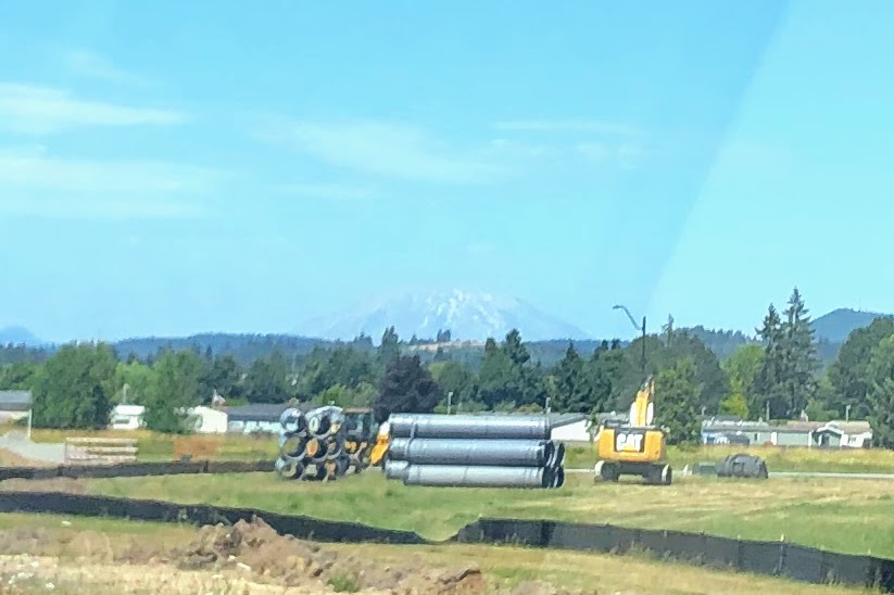
The moment I realized Mt. St. Helens fell along the general path of our Great Northwestern Road Trip, I knew it had to be a stop, and that if it could be climbed, we would climb it. A bit of research determined that Yes, climbing was very much an option, but permits were limited. I set my alarm for 6:55am on the 1st of June, five minutes before all permits for July would become available. At 7:00:34, I bagged two crisp climbing permits for July 29th.
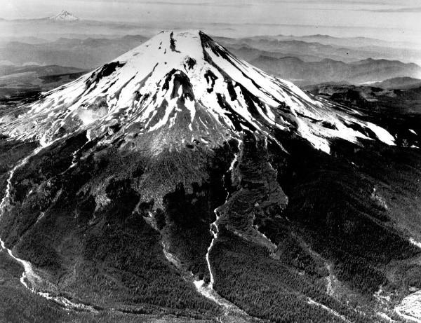
Pre-1980 – so pointy! 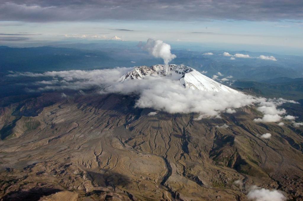
Post-1980. Ka-pew!
On the eve of our climb, we decided to consult with Ye Wise Olde Internet about how best to achieve success.
We approached the wise hermit with great reverence.
“Oh Wise Internet! Tell us what to expect from the Great Volcano!”
“When you arrive at the mountain,” Ye Internet intoned, “you will face these challenges three. One-“
“WHAT is your favorite color!” I interrupted, then cackled gleefully.
Ye Internet glared at me.
“Sorry, sorry. Couldn’t help myself. Please go on.”
“The first challenge will be to hike two miles through an extremely pleasant forest, gaining not one hundred, but one THOUSAND feet of elevation!”
“That’s basically my favorite kind of hike,” I scoffed. “Two whole miles to go a thousand feet? Piece of cake.”
Ye Internet ignored me and continued: “Next you will come to great piles of boulders over which you will have to clamber for TWO THOUSAND feet! Use of your hands will be required!!”
“Well that sounds like kind of a fun change from regular hiking. I’ve always liked climbing on boulders,” I said.
“They will have many sharp edges and every time you think you’ve almost finished you will come to a ridge and discover there are YET MORE BOULDERS. Seven-to-ten times will this disappointment come unto you!”
I frowned. “I guess that’s a lot of boulders, but we’ll get gloves. It’ll be great.”
“Lastly you will come to the cone of scree at the top of the mountain.”
“Oh no,” I said.
“Loose, villainous scree that will sink away beneath your feet -“
“Not like…”
“YES! Exactly like Cinder Cone except THREE TIMES MORE OF IT!!!” Ye Internet tipped back its head and cackled madly while I stared at my feet and started to reevaluate how badly I wanted to collect this volcano.
Dustin put a hand on my shoulder. “It’s not going to be that bad,” he assured me. “Ye Internet is just being sensationalist. Right Internet? Let’s hear some advice for how to make it as easy as possible.”
Ye Internet deflated a little. “Use hiking poles,” it muttered. “Nine out of ten climbers agree.”
“How long is this little event going to take?” I asked. Eight miles under average circumstances would take me about four hours, but with 4,500 feet of elevation to both gain and lose including – shudder – a 1,500-foot cinder cone, “regular” did not apply. I mentally doubled my usual time. Could we do it in eight hours?
Ye Internet closed its eyes and put its fingers to its temples.
“Ben R*. did it in five hours and fifteen minutes.”
“What?? Up AND down? No he didn’t.”
“He started at 1am and summited by sunrise at 4:30am. It took him just under two hours to come back down.”
“He’s a liar,” I said.
Ye Internet projected a picture of Ben R. into the room. “Look at him,” Ye Internet commanded.
I whistled low. Ben R. was a godling, all ropy muscles and bronzed skin and stoopid toothy white smile. I wanted to punch him.
“Matan K. reached the summit in two hours and twenty minutes,” Ye Internet added smugly.
“You are just being sensationalist. These people aren’t normal. How long does it take normal people?”
“Six and a half hours.”
I squinted suspiciously at Ye Internet. It shrugged.
“Seven hours? Eight hours? Twelve hours?” it added, scrolling through a month of reports. “But mostly six and half.” Obviously the people leaving reviews of this trail skewed heavily toward Very Fit.
“Can we talk about someone who’s a little more marshmallow-butt like me, please?”
“Tiffany C. did it in fourteen hours and twelve minutes.” The picture that popped up this time was of a 20-something woman who probably didn’t do a lot of hiking for fun. “Nicolette R. got her period halfway up. If she could still finish, so can you.”
“Poor Nicolette,” I said. “Okay, that’s more helpful. Maybe we can do it in ten?” I asked Dustin.
“Seems reasonable to me,” he said.
“When should we start?” I asked Ye Internet.
“Ben R. says 1-2am. You absolutely must be there for the sunrise.”
“Ben R. is really wrong about that. Besides, he’s already been disqualified as an authority.”
“The average hiker seems to start at 4am.”
“Slightly but barely more realistic,” I said. “Let’s start at 6am.” 6am would already be a full four hours earlier than I was likely to start a normal hike, given my druthers.
“I’ll set my alarm for 5:30,” Dustin said. I favored him with the same suspicious look I’d given Ye Internet. He was giving us way too much early-morning prep credit.
“Better make it 5:00,” I said. I turned back to Ye Internet. “How much water should we take?”
“Two liters. Or three and a half. Or five. Or six.”
“Six liters? Each??”
Ye Internet shrugged. “Depends on the weather.”
“I’m sure we’ll be fine with full bladders and our regular bottles,” Dustin said. I did a little mental calculation. That would be about 3.5 liters for me. Almost eight pounds. I sighed. At least it would get lighter as the hike progressed.
“What else do we need to know?” I asked.
Ye Internet considered. “Hiking poles are indispensable. Wear gaiters. Bring more snacks than you think you need. Hiking poles aren’t really necessary. The scree field isn’t actually that bad. Don’t pack too much food. Be sure to wear gloves. Or not.”
“Okay, okay. I get it. You’ve been very helpful.”
“Five o’clock, then?” Dustin confirmed, setting his alarm. I nodded. I was full of trepidation and my knees already ached in anticipation.
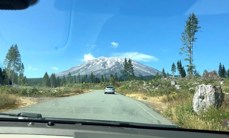
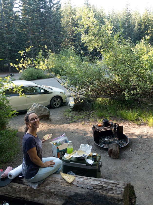
We camped the night before our hike at Climbers Bivouac campground in the Gifford Pinchot National Forest, located right at the Mt. St. Helens trailhead. Rather than pack up and make a 30-minute drive in from the nearest hotel, we’d only have to toss our camping gear into the car and roll.
We arrived at 4:30pm hoping to snag one of the 14 established campsites. Dispersed camping is also permitted, but being able to park right next to our campsite felt important. We need not have hurried. All but two of the established sites were still open when we arrived, giving us our pick. We pitched our tent, watched a handful of people come down off the mountain, and had a leisurely dinner of tamales, purchased from a street vendor in Portland. Fanciest camp dinner to date.
Ye Internet had advised us to bring earplugs. “It’s not that people are inconsiderate,” he reported a hiker from last week saying, “it’s just that they start arriving in the middle of the night and it’s a lot of people moving around.”
We brought earplugs and used them, but Ye Internet was wrong. “Inconsiderate” was the only appropriate word for these hikers. At 3am, a group of bro-dudes started their hike with a round of whooping and chest-thumping loud enough to wake people in that hotel half an hour away. I didn’t specifically hear it, but I’m pretty sure they were also smashing beer cans against their foreheads.
From then out, the campground was a nonstop series of car doors slamming and people hollering at each other. When our alarms went off at 5:00, it was no great difficulty to roll out of the tent since we’d been faking sleep for the last two hours anyway.
Coffee and tea for alertness. The healthiest, slimiest oatmeal you’ve ever met for energy. Stale donuts for luck. Dew-damp tent disassembled and crammed unceremoniously into the car. Packs donned. The time was now 6:30am.
(Seriously, how are we so bad at this? How did it take us NINETY minutes to get ready when we didn’t even properly pack up our gear?)
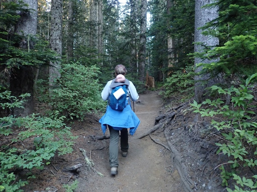
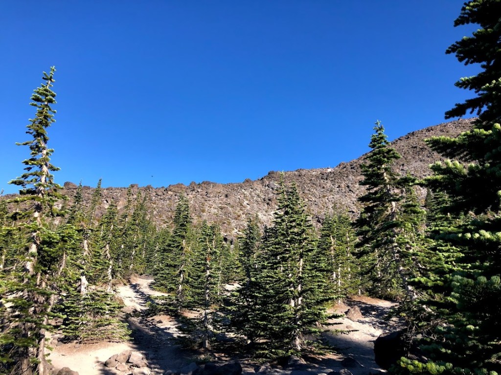
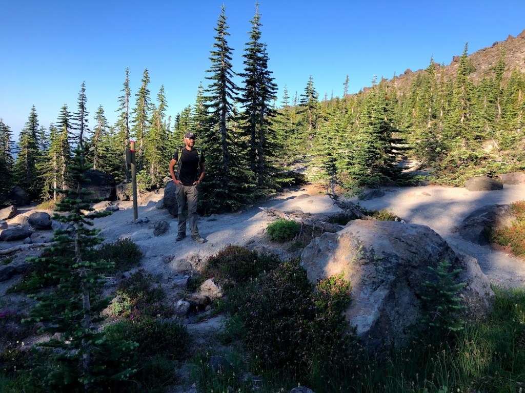
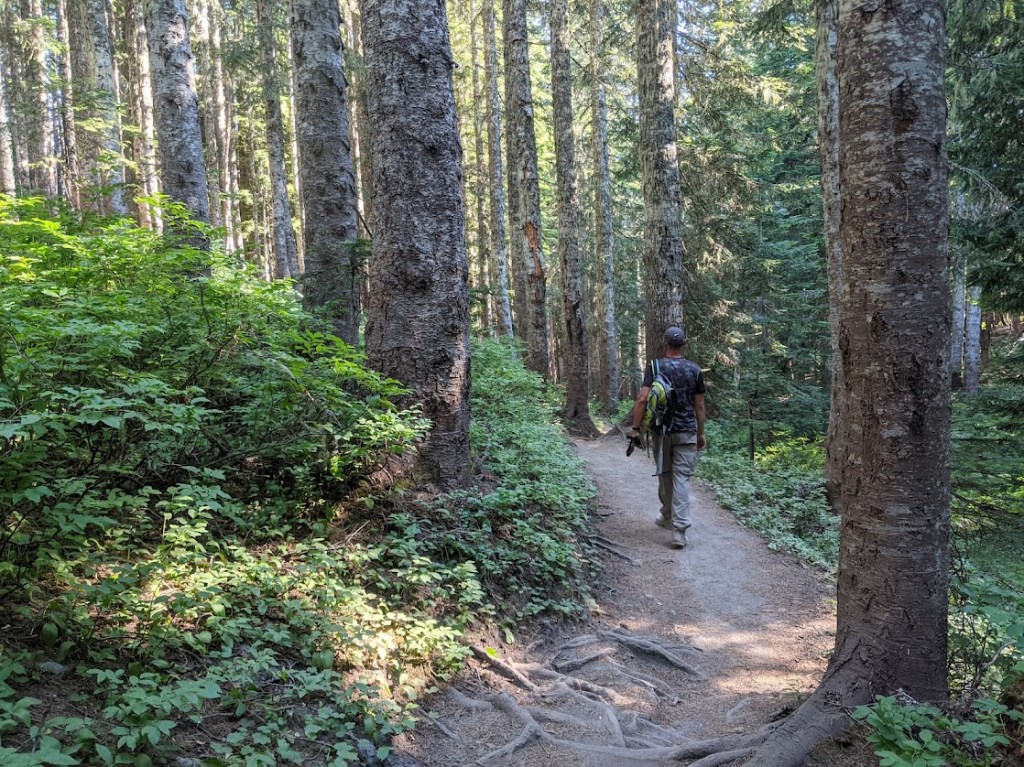
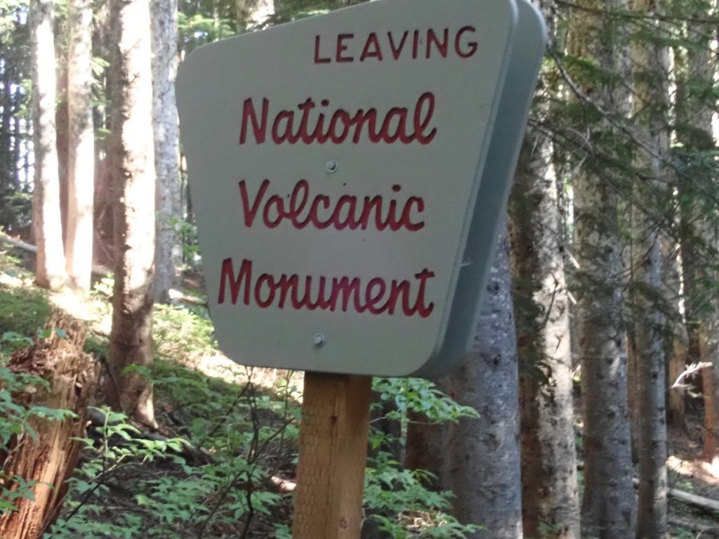
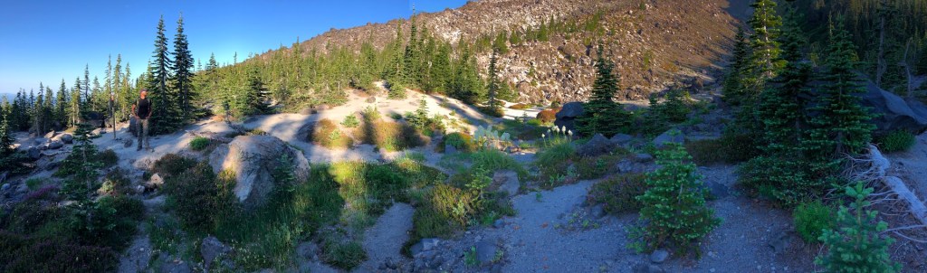
By 6:30am, the sun had fully made an appearance, so we ditched our headlamps (oh, the optimism!) in the car before setting out. The forest at the base of Mt. St. Helens is lovely and the slope of the path was kind, as we’d been led to expect. It was also very, very quiet. Only 110 hikers per day are allowed permits, but we didn’t see another soul on the trail for the first two miles.
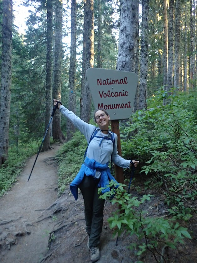
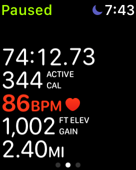
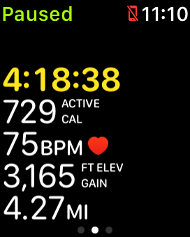
We arrived at the end of the forest at 7:43am, 74 minutes after starting. My apple watch registered 2.4 miles, rather than the 2 Ye Internet had promised, but the watch also reported we’d come up almost exactly 1,000 feet. That meant the remaining 3,500 feet would happen over only 1.6 miles. That’s not hiking, kids.
Fortunately, my watch is not known for being very accurate regarding ongoing elevation gain. It’ll get the maximum and minimum elevations just right, but on a moment-to-moment basis it tends to underestimate how many feet we’ve gained. I crossed my fingers and hoped it was off by a lot. (Spoiler: it wasn’t.)
This was the moment we saw the first other hikers of the trip. Three bros, shirtless and carrying a single bottle of water each, came thumping down out of the rocks.
“Going all the way to the top?” one asked.
“Uh huh,” I replied, suppressing the much more sarcastic response that their idiotic attire seemed to deserve. Nooooo, we’re just out for a nice stroll in the woods at the bottom of this incredible volcano before 8am while carrying eight pounds of water and a climbing permit. What are YOU doing?
“Good luck,” said one bro. Another grunted. The third ignored us. They disappeared down into the trees. Why had they wished me luck? Did I look like I needed it? Did I look weak?
Probably.
“I don’t think they had a permit,” I muttered.
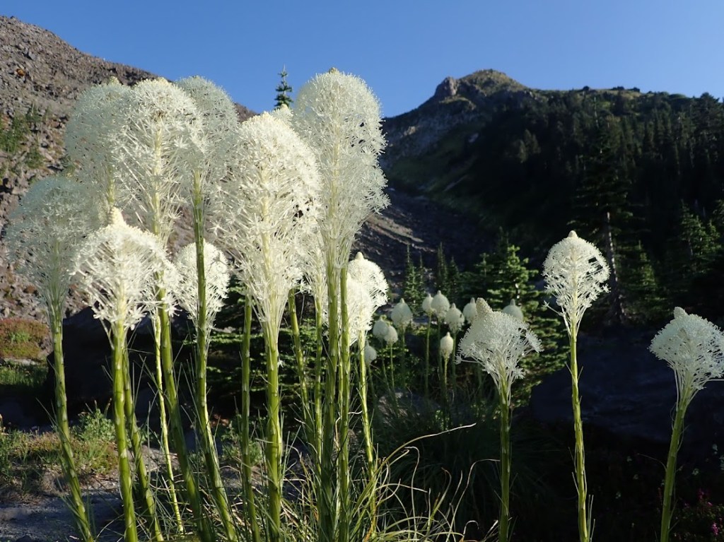
We parked on the rocks at the edge of the trees, surrounded by wildflowers, to enjoy a fortifying snack before starting the rock-clambering portion of our day.
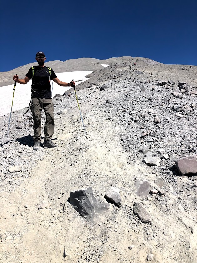
There’s nothing for it but up, then. And as I’d told Ye Internet, scrambling over rocks kind of sounds like fun to me. Tally-ho.
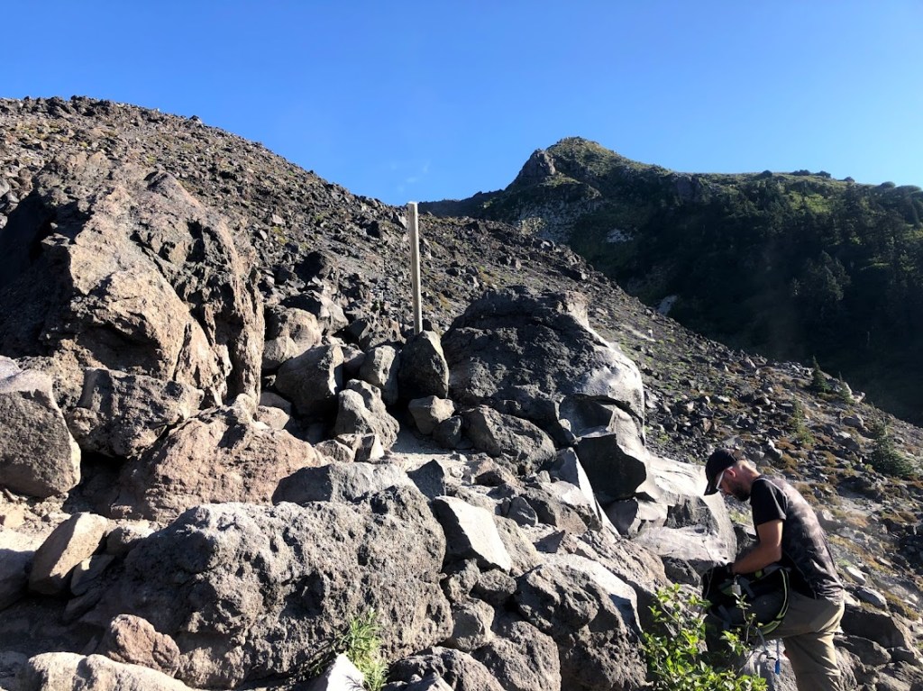
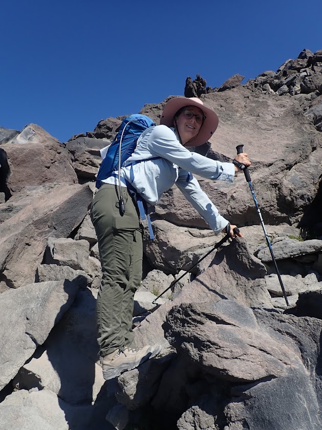
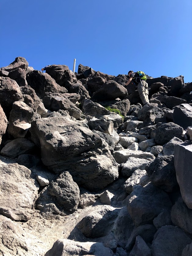
Ye Internet was right about the waves of boulders. I thought I had been prepared, but as we got on toward the sixth or seventh or hundredth wave of boulders, I started to wonder how it could be possible for there to be more. I’d been climbing for weeks, surely there could not be more. But there were.
At some point about halfway through, I demanded of Dustin: “Whose terrible idea was this, anyway?”
“Yours,” he said. He didn’t even hesitate.
“Oh,” I huffed, because huffing was the only way I could get air in and out at the moment. “Right.”
“But I supported the idea,” he added. Supportively.
“It was a great idea,” I gritted out through clenched teeth as I hauled myself up over another sharp rock.
I spent the rest of the climb repeatedly reminding myself that I was here because I wanted to be here. I wanted to be here. I wanted to be here. This was a great idea. Just think how great I’d feel when I got to the top! I wanted to be here. This was fun. I was having a great time. This was my idea. I wanted to be here.
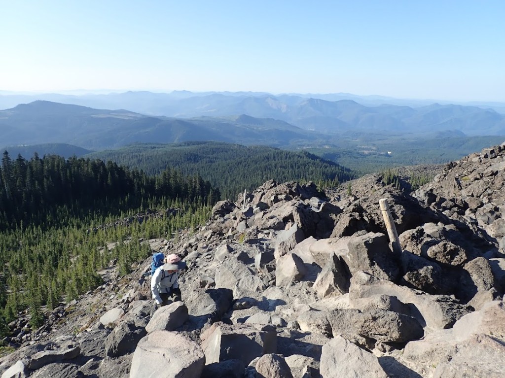
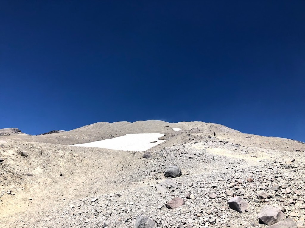
Three hours later, the boulders rather abruptly came to an end and we had nothing left between us and the summit but – weep! – a mountain of loose scree.
In those three hours, we’d come a little less than two miles, gaining about 2,200 feet of elevation. Technically, the whole hike was only 4 miles long, but whoever had measured that distance clearly had not picked their way over and around all these boulders.
So how many miles of horror awaited me? Maybe one mile? Maybe another 1,200 feet up?
The only solution was to eat more snacks. And then, I guess, climb a cone.
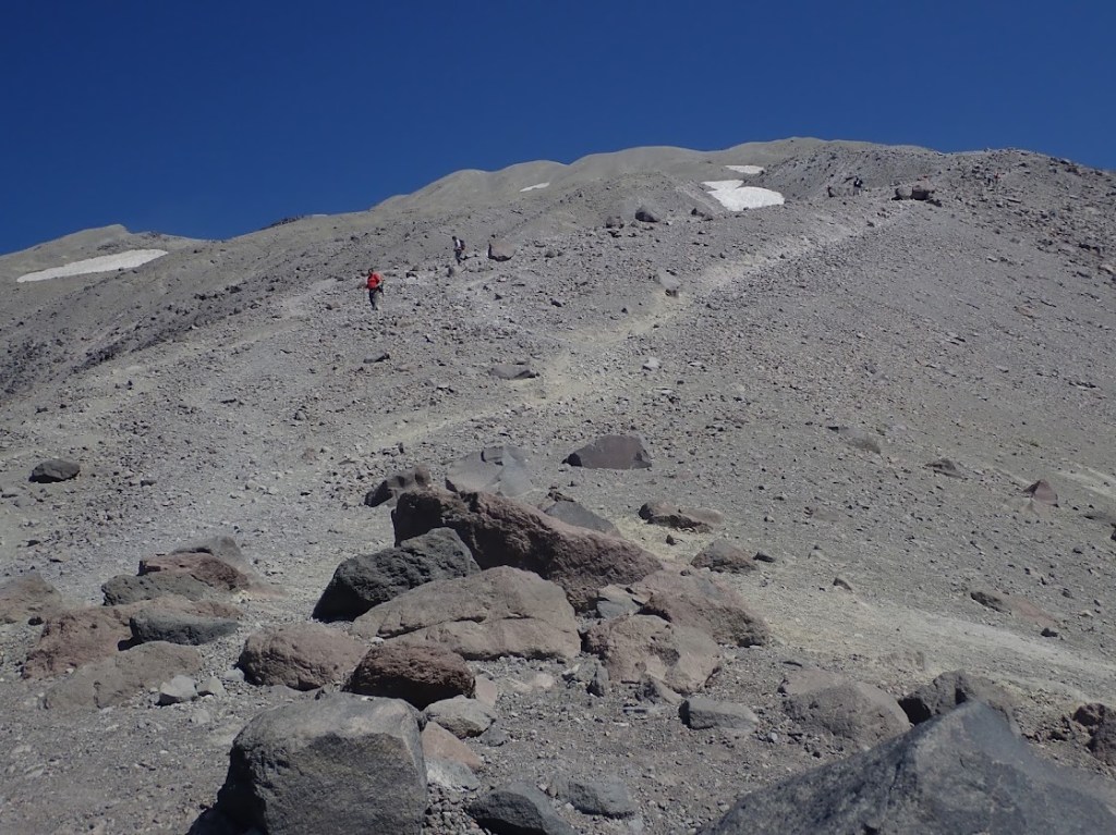
To my vague relief (all emotions felt vague at this point), the scree did not start out terribly loose. The slope was ridiculously steep, but instead of losing half your progress with every step, as on Cinder Cone, you could count on keeping all but a few inches. The trail snaked all over, dividing and branching and converging as this year’s thousands of hikers each tried to determine the best way to the top. There is no best way, though. All you can do is go up and up some more.
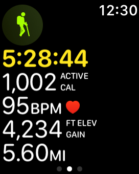
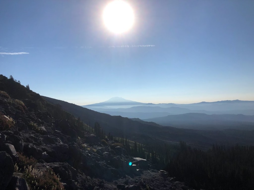
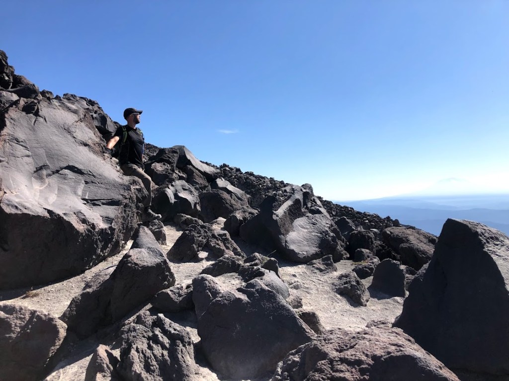
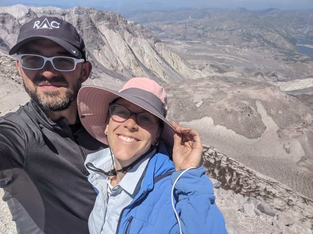
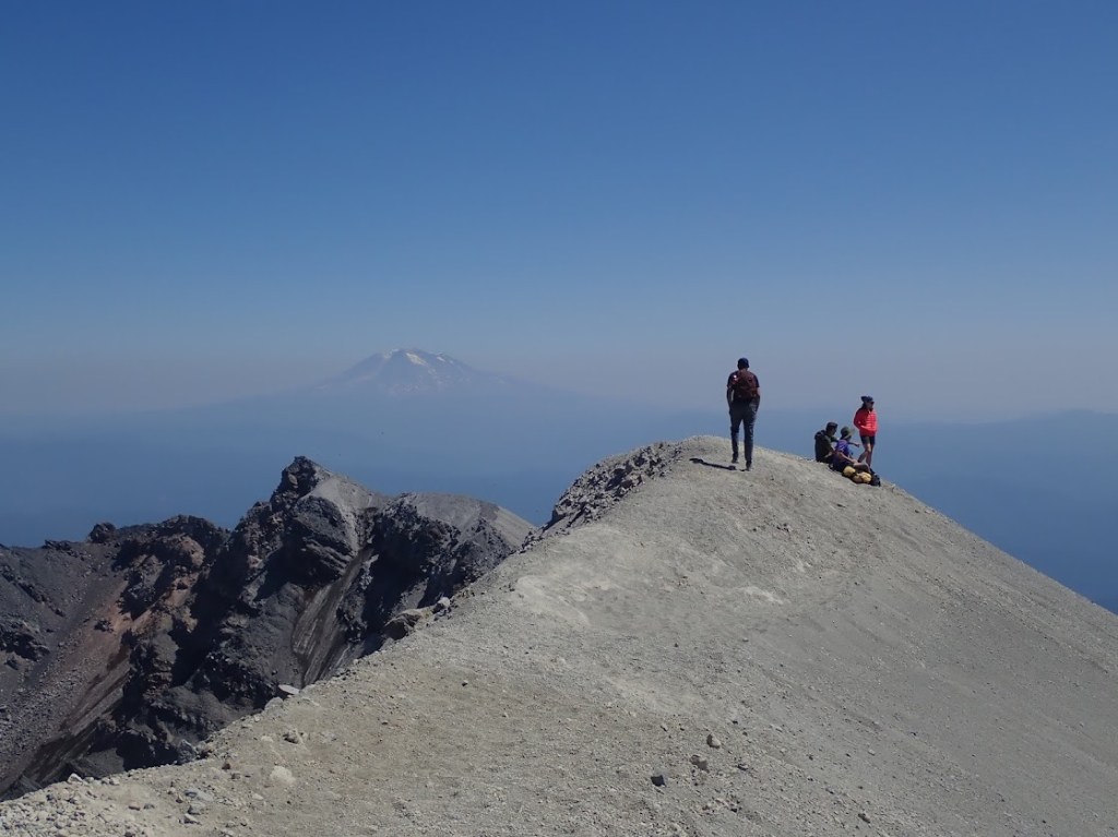
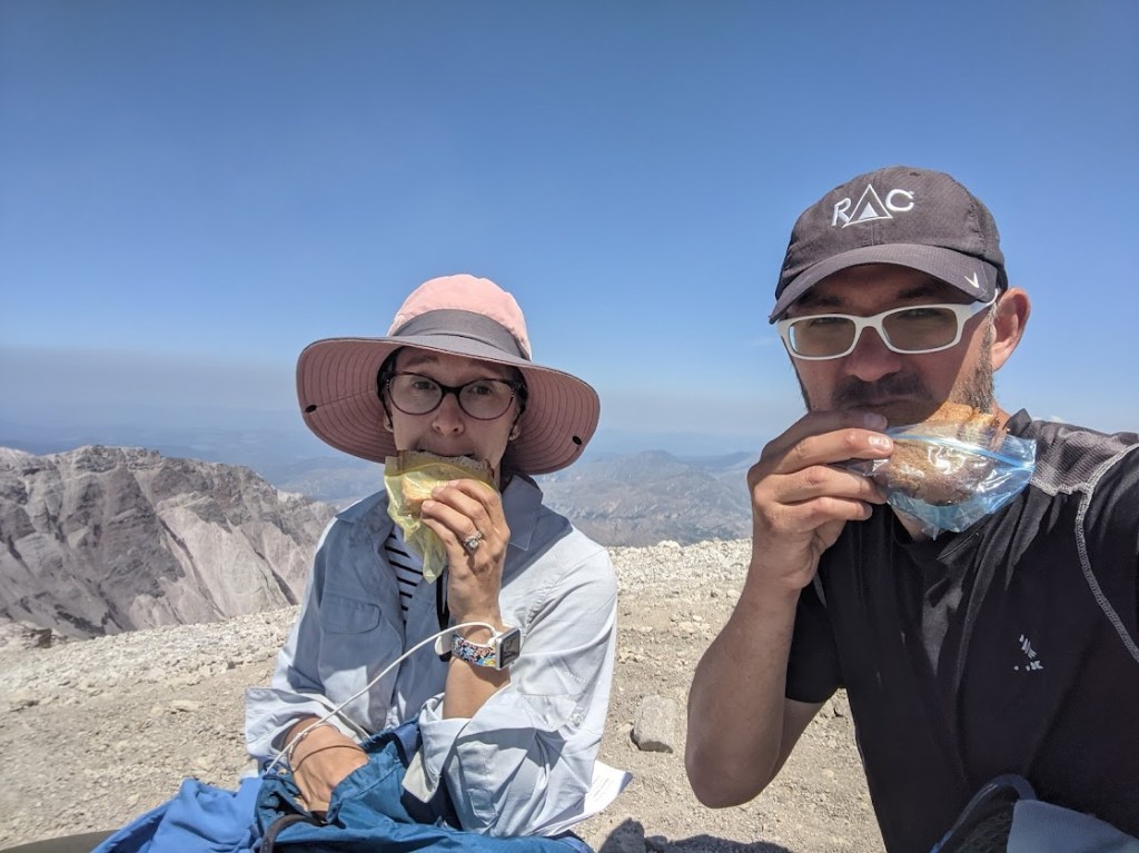
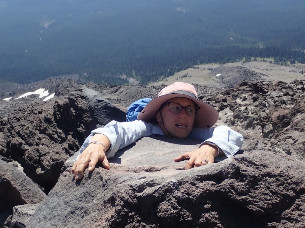
AND THEN WE REACHED THE TOP.
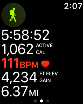
Five an a half hours, 5.6 miles of route-picking, “4,234” feet up. The official watch min and max elevations eventually clocked in at 3,700 feet and 8,275 feet, making the actual elevation gain 4,575 feet. Shazam. Not even our hike out of the Grand Canyon netted us that much gain.
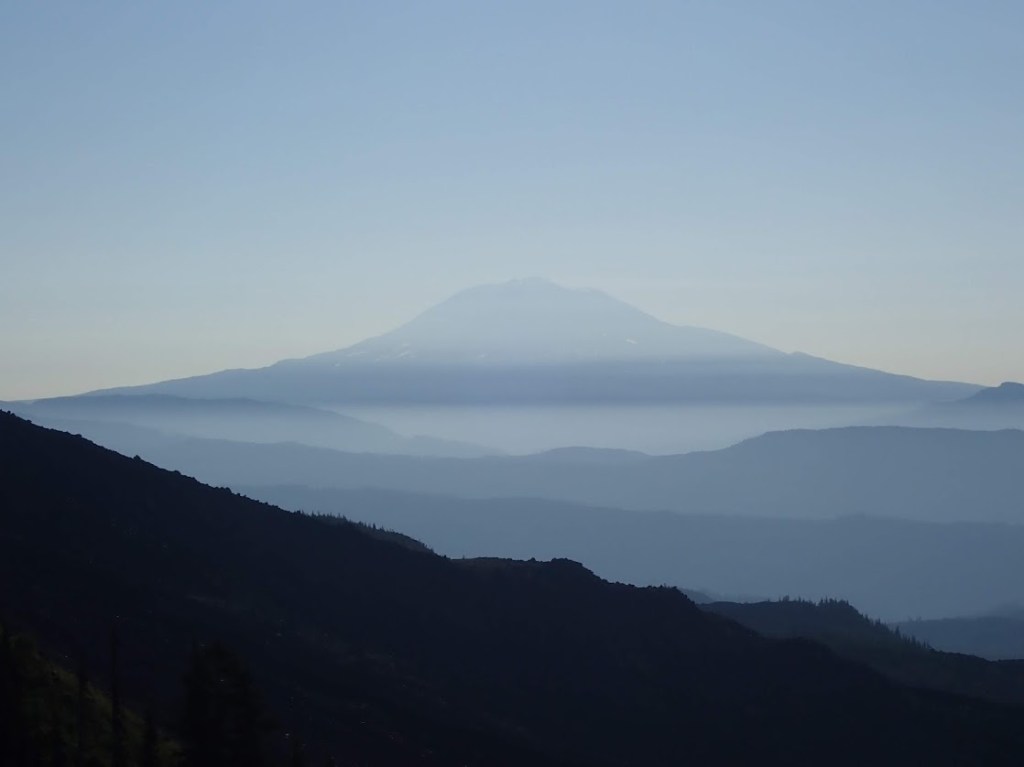
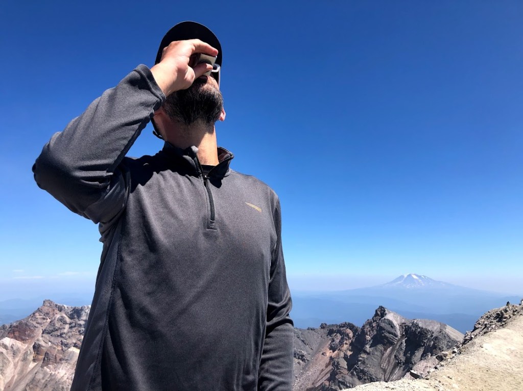
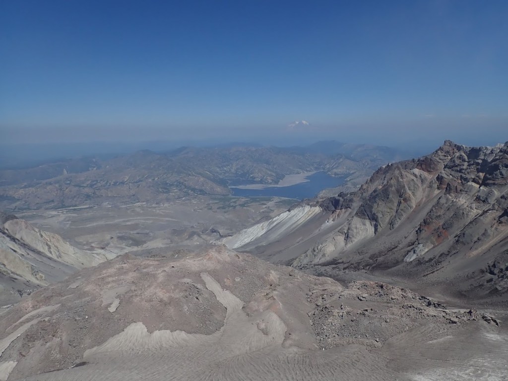
Given the wind, we opted not to make the rather frightening trek over to the true summit, about fifty feet higher and a quarter mile around the crater rim. I saw the smoking vent – that’s completionist enough for me.
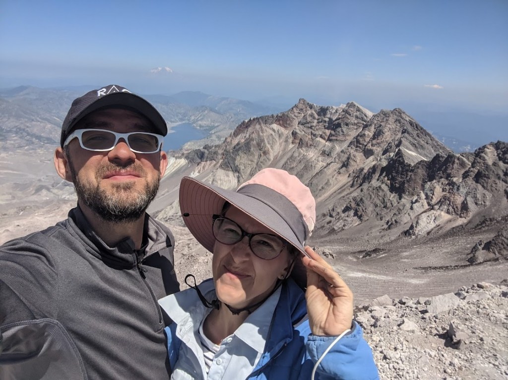
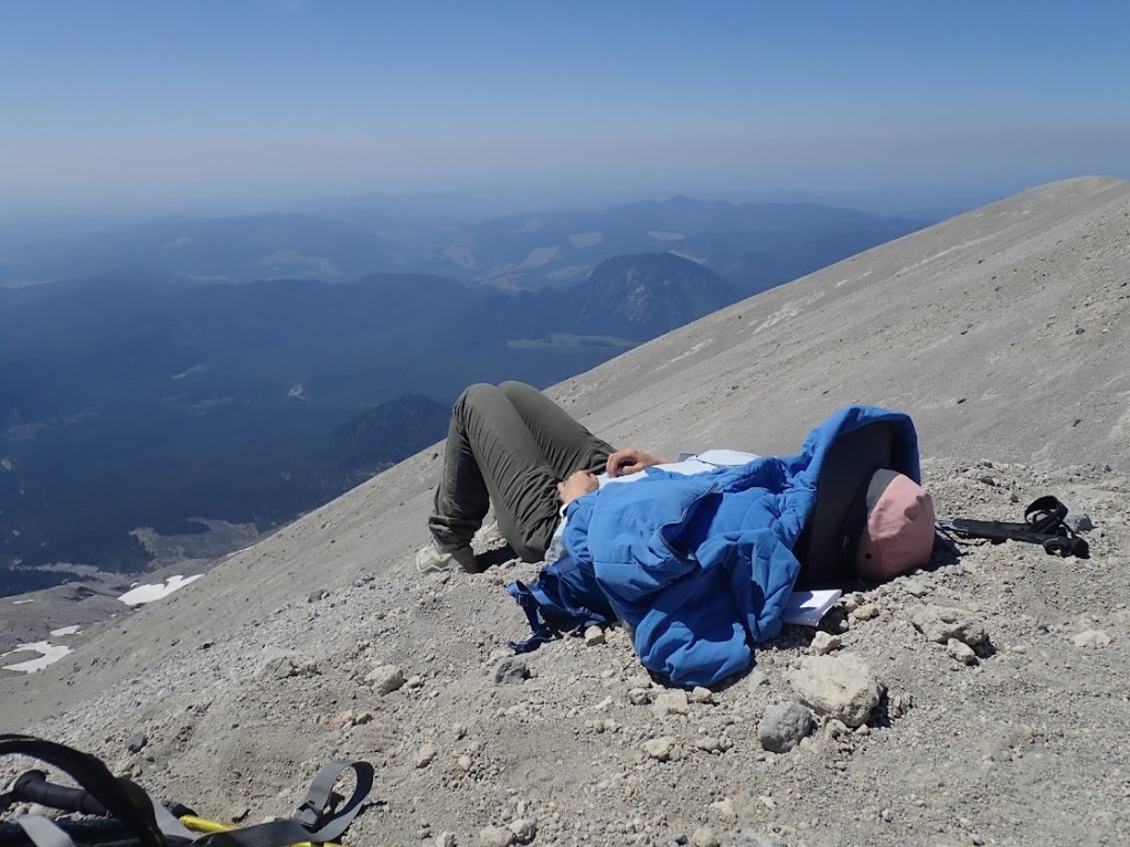
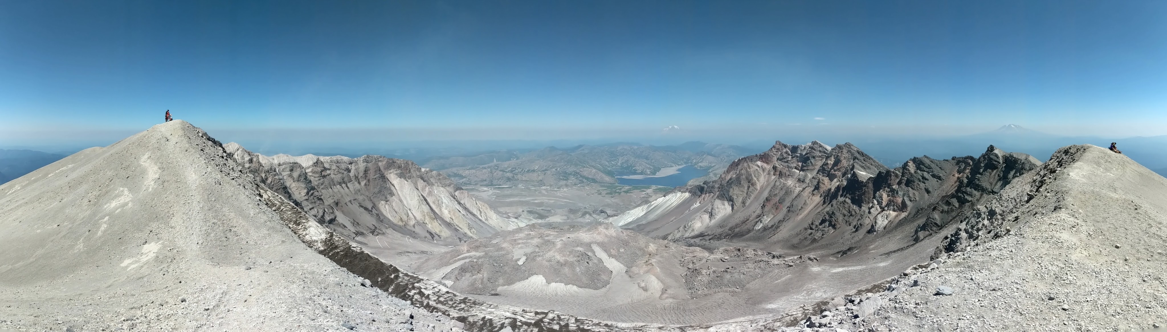
We watched rockslides and basked in our victory for about an hour before starting the trek back down.
The scree slope, in keeping with what we learned at Cinder Cone, was an absolute joy to descend, with each step doubling its own length as the loose rocks and dirt slid away beneath our feet. It took 30 minutes to go down what had taken 75 to go up. Also, somehow, the down distance was only .8 miles, while the up distance had been 1.3? My watch was SO confused by how differently I moved going up versus down. We may never know what that distance actually was…
At first, going down the boulder field was more fun than coming up it had been. Progress felt faster and new muscles were being used. Soon enough, though, pain and tedium set it. There was no way we could have crossed as many boulders coming up as we faced going down.
Ah ha! The boulder field actually was longer on the way down! A whole .13 miles longer. So much for my intuitive sense of best-route-finding. Despite my also-apparently-flawed sense that this portion of the hike took 72 hours, it actually only took 1:50, compared to the three hours up.
But, oh! the knees! By the time we reached the forest, I was making the same involuntary “ouch! ouch! ouch!” noises with every step that the hike to the bottom of the Grand Canyon had produced.
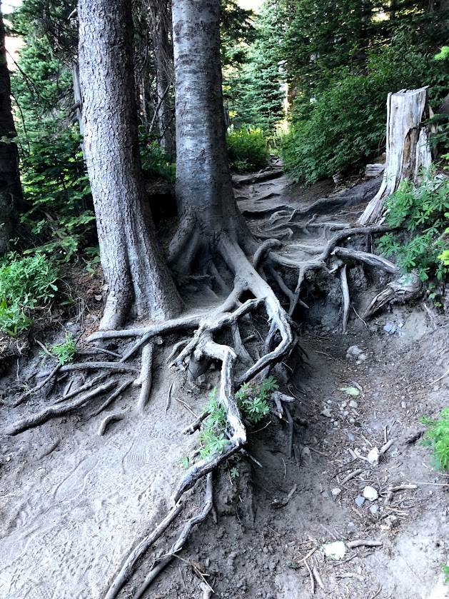
The last 2+ miles through the forest also felt impossibly long. What had seemed like a gentle slope on the way in now seemed like a constant battle with roots that wanted to trip my ten-ton feet.
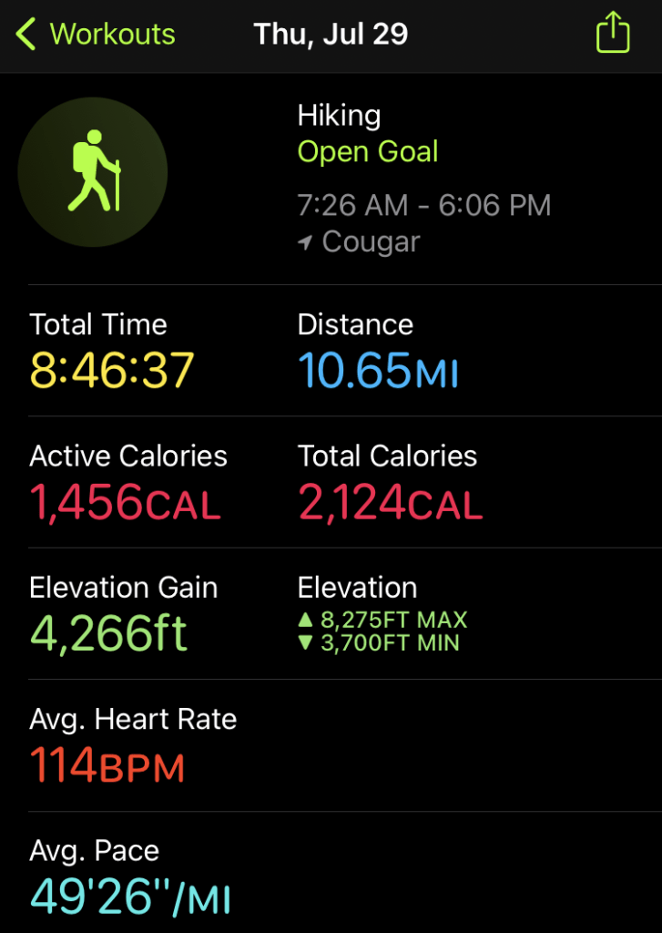
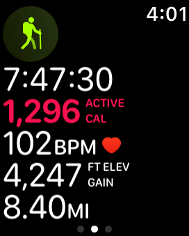
Not quite nine hours of active hiking over 10.5 clock hours still means I totally made my 10-hour goal. (My watch apparently recorded the hike on Mountain Time – I swear we really left at 6:26am.)
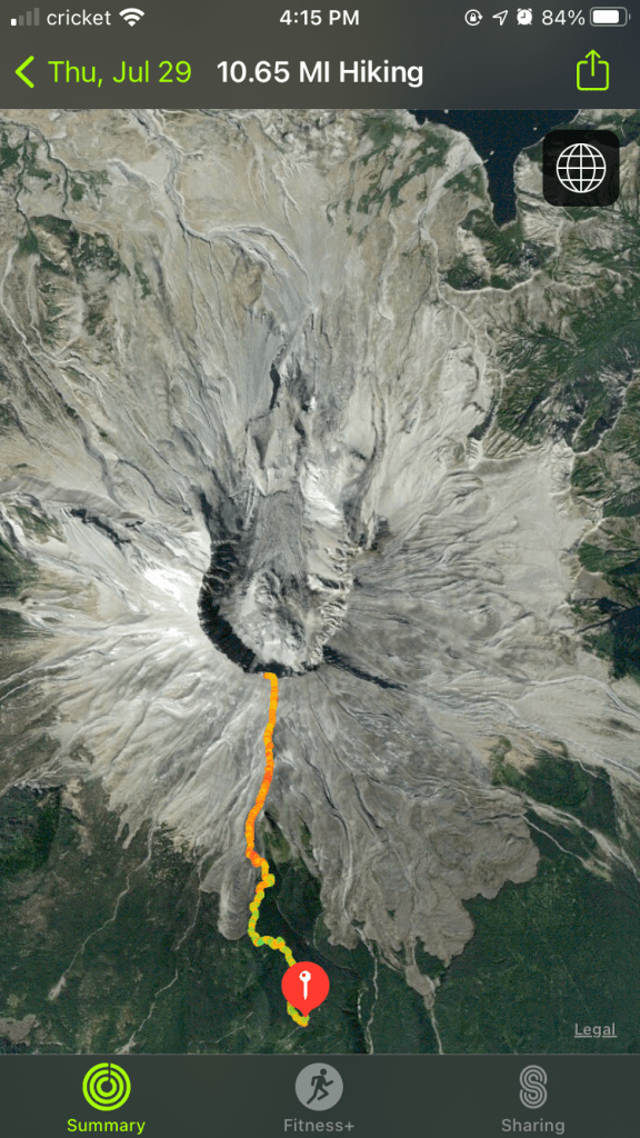
All the maps say this is an 8-mile round trip hike, but my watch is pretty excellent at tracking distance. I’m sure the very straight lines drawn on the trail maps equal four miles each way, but by the time one finishes snaking around all those boulders, it’s easy to understand where an extra 2.65 miles might have appeared. This is possibly the least-linear straight-line hike I’ve ever done.
As anticipated, having done it makes me feel SO GREAT. Sitting at the crater rim, watching this living volcano breathe was unlike anything else I’ve ever done.
Would I do it again…..? Nyeh. There are so many other volcanos I still need to collect. Maybe once I run out of those.
* All claims and most phrasing regarding how and how quickly people climbed this mountain are from actual reviews left on alltrails.com between 6/1/21 and 7/28/21 – I did not make this crap up.

2 thoughts on “Climbing Mount Saint Helens”