Through Wire Pass and down the slot canyons…
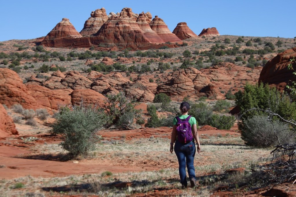
Now we head out to the Teepees.
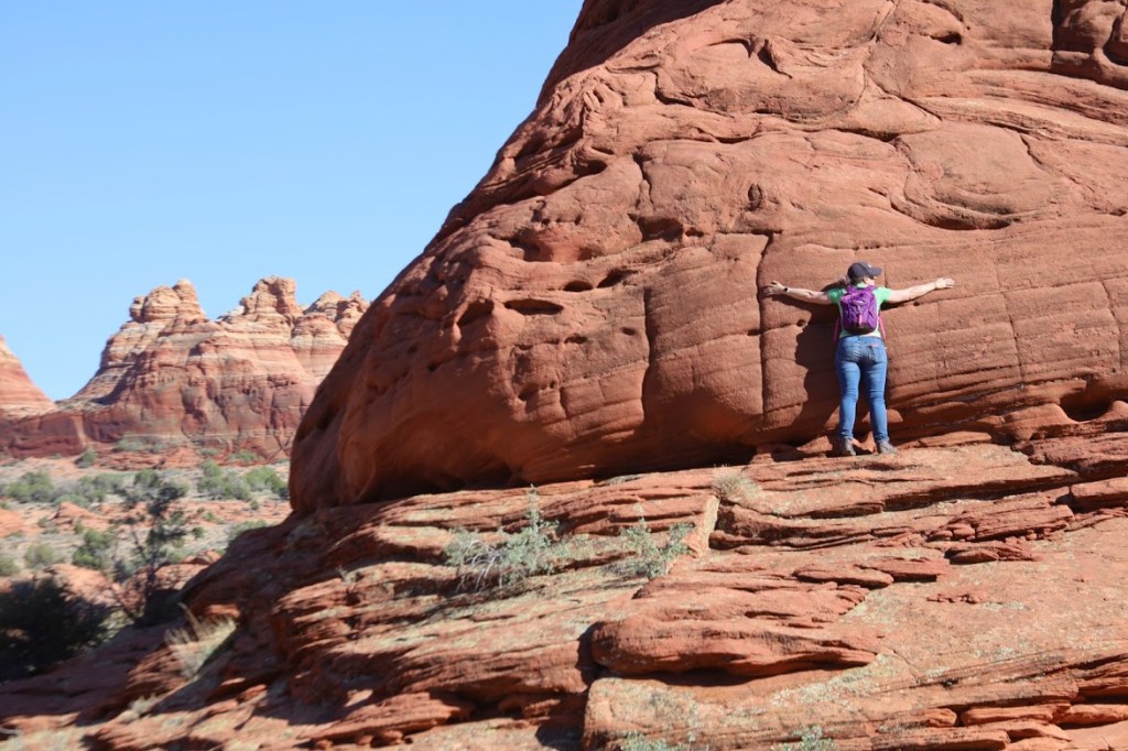
And now a break for some really gorgeous rocks…
Transcription:
Tuesday, May 2021
VERMILLION CLIFFS NATIONAL MEMORIAL
Okay! Rested, recharged, and off for more adventures. We failed to win the lottery for the Wave again this morning, so we implemented backup plan The-Wire-and-Teepees. These hikes both require a day-use pass, which Dustin was organized enough get well in advance. (Don’t to forget to do this, kids! You can buy them online, but data connections at the trail head are iffy at best.)
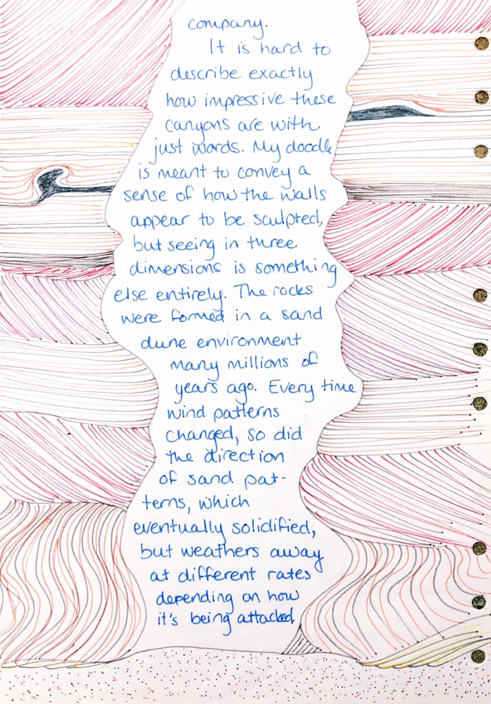
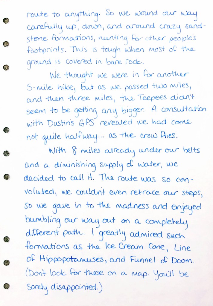
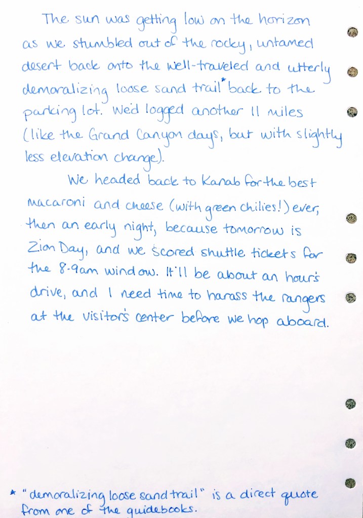
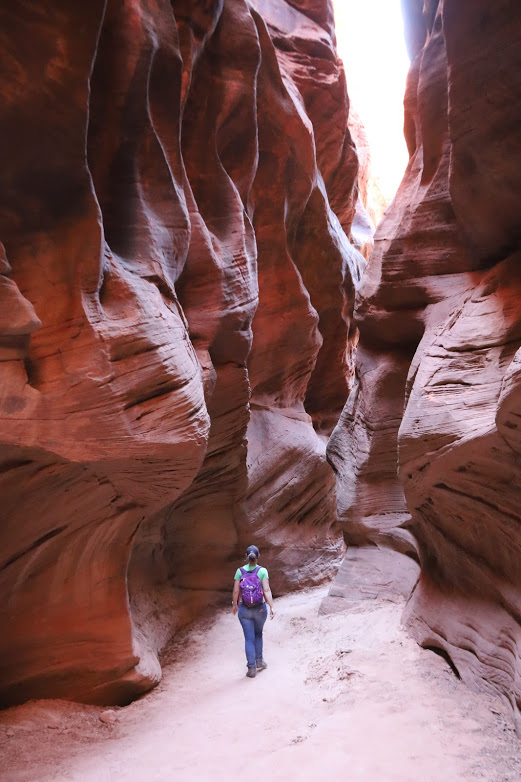
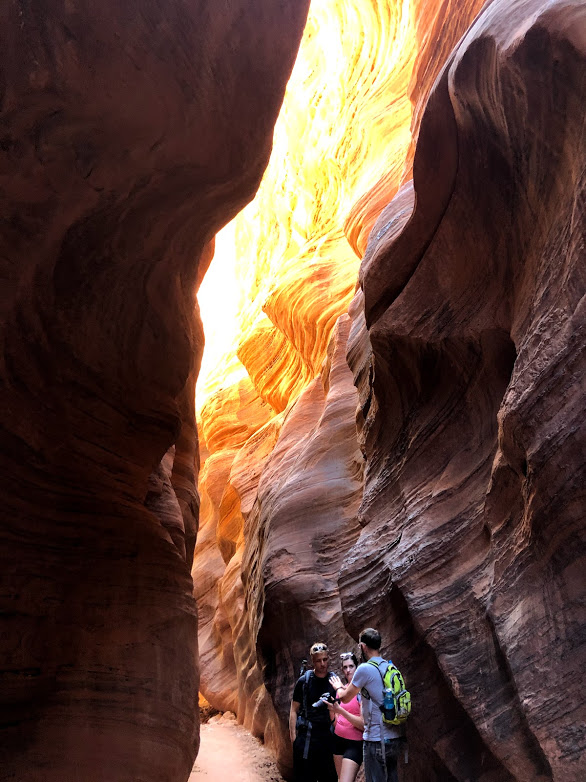
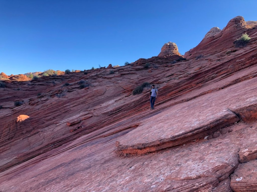
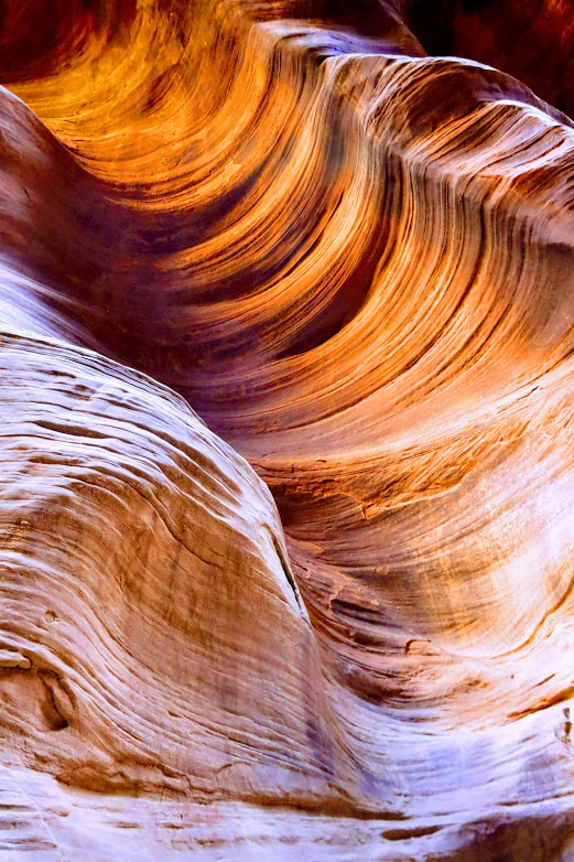
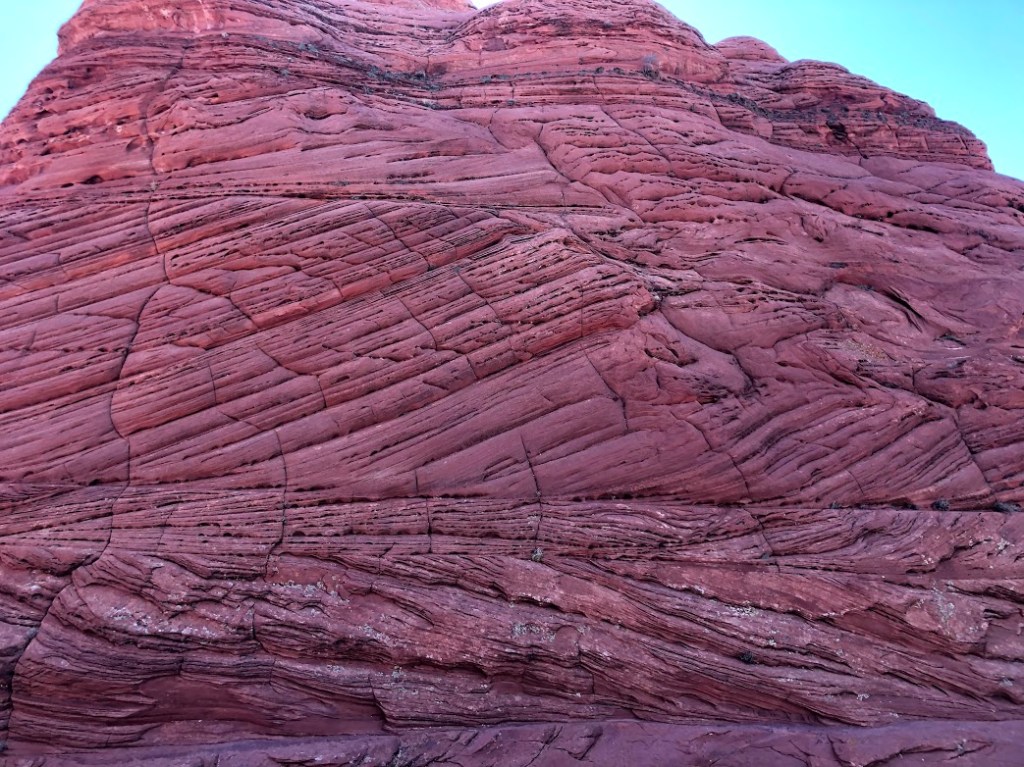
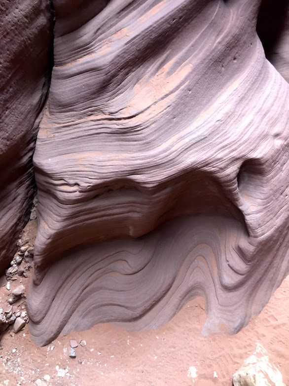
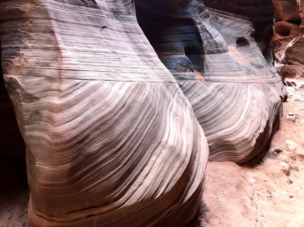
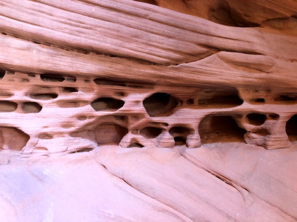
[Like the Wave,] The Wire is also a wildly popular hike, though in this case there are no restrictions on how many people can go on a given day. The trail winds back through a series of slot canyons (canyons with very narrow access) that become more and more impressive the farther you go. Happily, the farther you go, the fewer people keep you company. It is hard to describe exactly how impressive these canyons are with just words. My doodle is meant to convey a sense of how the walls appear to be sculpted, but seeing it in three dimensions is something else entirely. The rocks were formed in a sand dune environment many millions of years ago. Every time wind patterns changed, so did the direction of sand patterns, which eventually solidified, but which weathers away at different rates depending on how it’s being attacked.
At points along the trail, the walls above us were 200 feet high, and even though we did all of the hike during day’s middlest hours, in most cases no sunlight reached the bottom.
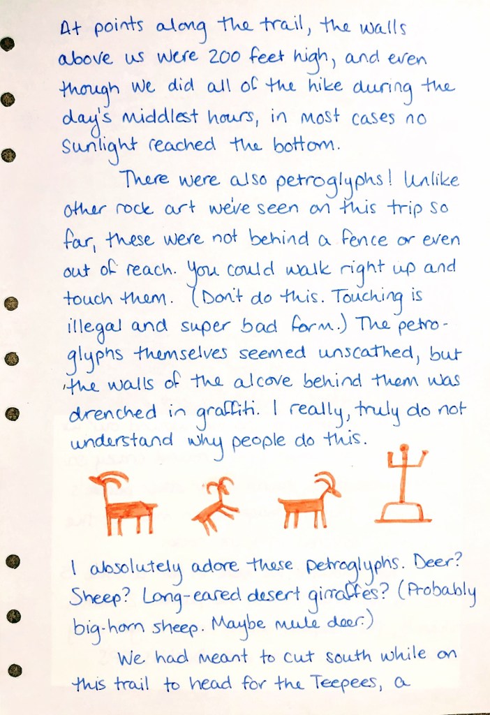
There were also petroglyphs! Unlike other rock art we’ve seen on this trip so far, these were not behind a fence or even out of reach. You could walk right up and touch them. (Don’t do this. Touching is illegal and super bad form.) The petroglyphs themselves seemed unscathed, but the walls of the alcove behind them was drenched in graffiti. I really, truly do not understand why people do this.
I absolutely adore these Petroglyphs. Deer? Sheep? Long-eared desert giraffes? (Probably big-horn sheep. Maybe mule deer.)
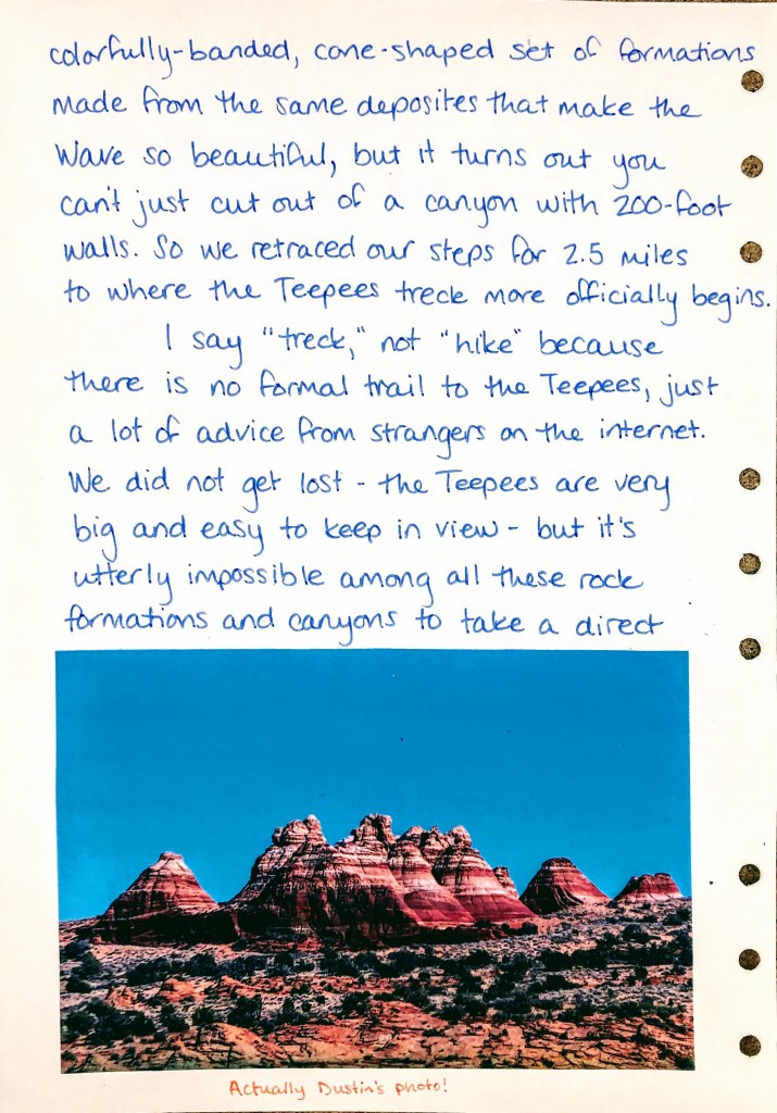
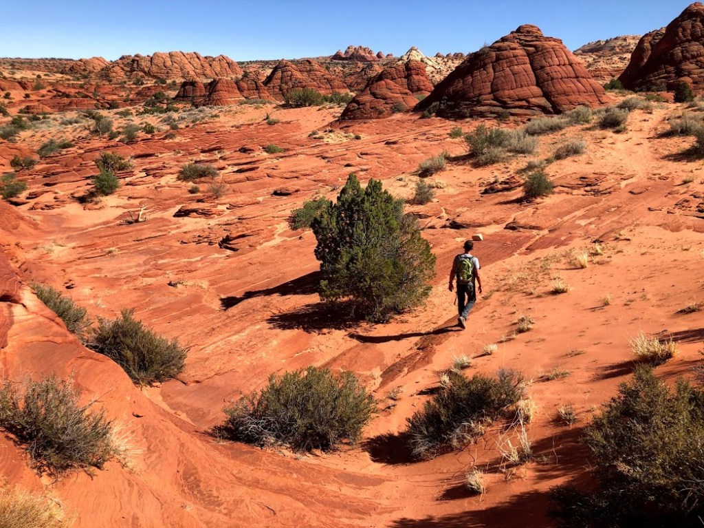
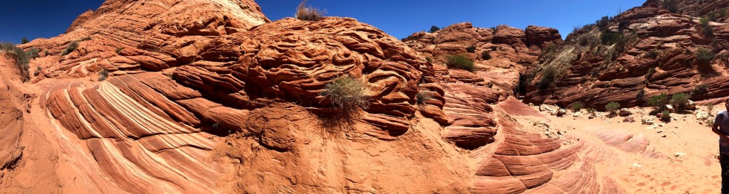
We had meant to cut south while on this trail to head for the Teepees, a colorfully-banded, cone-shaped set of formations made from the same deposits that make the Wave so beautiful, but it turns out you can’t just cut out of a canyon with 200-foot walls. So we retraced our steps for 2.5 miles to where the Teepees trek more officially begins.
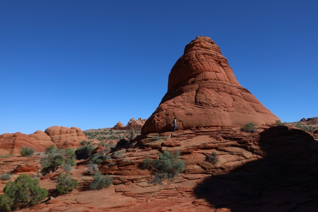
I say “trek,” not “hike” because there is no formal trail to the Teepees, just a lot of advice from strangers on the internet. We did not get lost – the Teepees are big and very easy to keep in view – but it’s utterly impossible among all these rock formations and canyons to take a direct route to anything. So we wound our carefully up, down, and around crazy sandstone formations, hunting for other people’s footprints. This is tough when most of the ground is covered in bare rock.
We thought we were in for another 5-mile hike, but as we passed two miles, and then three miles, the Teepees didn’t seem to be getting any bigger. A consultation with Dustin’s GPS revealed we had come not quite halfway… as the crow flies.
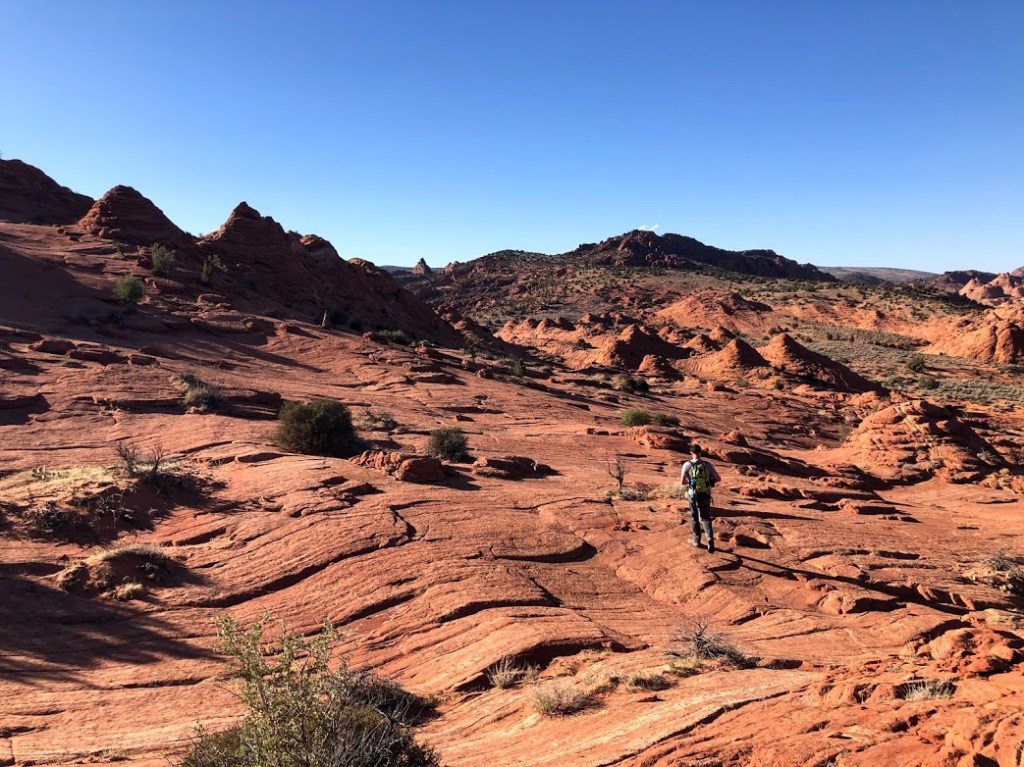
With 8 miles already under our belts and a diminishing supply of water, we decided to call it. The route was so convoluted, we couldn’t even retrace our steps, so we gave in to the madness and enjoyed bumbling our way out on a completely different path. I greatly admired such formations as the Ice Cream Cone, Line of Hippopotamuses, and Funnel of Doom. (Don’t look for these on a map. You’ll be sorely disappointed [when you discover I invented all those names].)
The sun was getting low on the horizon as we stumbled out of the rocky, untamed desert back onto the well-traveled and demoralizing utterly loose sand trail back to the parking lot. We’d logged another 11 miles (like the Grand Canyon days, but with slightly less elevation change).
We headed back to Kanab for the best macaroni and cheese (with green chilies!) ever, then an early night, because tomorrow is Zion Day, and we scored shuttle tickets for the 8-9am window. It’ll be about an hour’s drive, and I need time to harass the rangers at the visitor’s center before we hop aboard.
* “demoralizing loose sand trail” is a direct from one of the guidebooks. quote

One thought on “Laura’s Journal: Vermillion Cliffs National Monument”